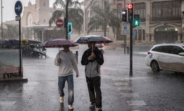
Severe weather has once again struck eastern Spain, leaving chaos and destruction in its wake. Valencia and Castellón found themselves at the center of a powerful storm, which brought heavy rains, flooding, and disruptions to transportation. In some areas, the highest level of alert has been declared, and meteorologists are warning that conditions may worsen further.
Overnight, the La Saleta creek overflowed in Aldaia, forcing emergency services to work around the clock. In Tarragona, thousands of residents were left without electricity due to damage to power lines. As a result of the storm, schools and kindergartens in Valencia province and parts of Catalonia have been temporarily closed to ensure the safety of children and staff.
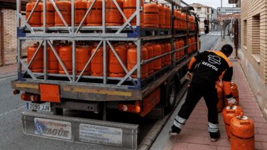
Firefighters and rescue workers labored through the night. In Castellón, they had to rescue a driver trapped in a vehicle surrounded by water in Sant Jordi. In Aragón, road crews assisted motorists stranded on rural roads, while in Botorrita they responded to a gas leak caused by infrastructure damage from the downpour.
The situation remains particularly difficult along the Valencian coast, the south of Tarragona, and the north of Castellón. According to forecasts, up to 180 liters of rainfall per square meter may fall here within a few hours. Along the Valencian coast, the red alert will remain in effect until late evening, while in Murcia and Tarragona, an orange warning has been issued. In other regions, including the Balearic Islands, Albacete, Almería, Granada, and Jaén, a yellow alert is in place due to the risk of heavy rain and thunderstorms.
Meteorologists note that the extreme weather is caused by remnants of the former hurricane Gabrielle, which transformed into a powerful cyclone, as well as a cold front at high altitude. This combination leads to sudden and intense downpours that are difficult to predict in terms of exact location and timing.
Temperature fluctuations have also drawn attention: a sharp drop in temperatures is expected in central regions of the country, while in the southwest the weather will turn warmer. Winds are strengthening, especially in the area of the Strait and the Alboran Sea, where gusts may reach storm levels.
Authorities and civil protection services strongly advise residents not to take unnecessary risks and, if possible, to stay at home. Avoid attempting to cross flooded roads, ravines, or underpasses. Most incidents occur when drivers ignore warnings and try to drive through hazardous areas.
Meteorologists do not predict an improvement in the weather in the near future. In the coming days, precipitation may reach eastern Andalusia, although it will be less intense there. Cloudy skies and light rain are expected in the north of the Canary Islands and the Cantabrian region, while conditions remain calmer in other parts of the country.