A powerful storm, named Claudia, has disrupted daily life since midweek in the Canary Islands and the northwest regions of Spain. Starting Wednesday morning, residents across the archipelago and coastal areas of Galicia, Cantabria, and Asturias have faced torrential rains, thunderstorms, and hurricane-force winds in some places.
Authorities have issued an orange weather alert in several autonomous regions. In Galicia and northern parts of the peninsula, the warnings cover not only heavy rain but also dangerous sea conditions. On the Canaries, alerts have been issued for La Palma and Tenerife, where rains and winds intensified by Wednesday evening, with thunderstorms also possible. Over the next 24 hours, other islands in the archipelago will be affected by the storm, though Lanzarote and Fuerteventura are expected to see less intense rainfall.
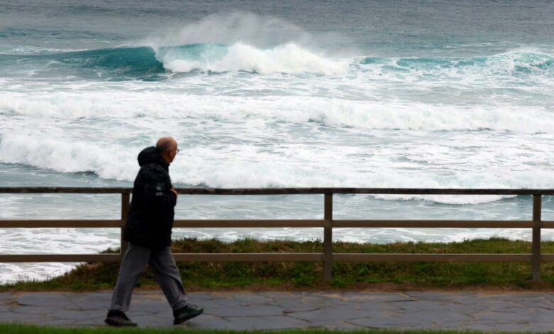
There is particular concern about sudden water surges in mountain streams and landslides, especially in La Palma, Tenerife, La Gomera, and El Hierro. These areas are expected to be hit hardest by the storm. Residents and tourists are advised to avoid hiking through ravines and along the coast, where waves may pose a serious danger.
Weather anomalies and temperature records
Amidst a raging storm, temperatures remain unusually high for November. In some northern cities, thermometers climb to 25°C, while Granada records nearly summer-like 28°C. In the southeastern provinces such as Almería, Murcia, and Palma de Mallorca, temperatures are expected to reach up to 27°C on Thursday and Friday, with Melilla possibly experiencing a spike above 30°C.
At the same time, much of the peninsula remains cloudy, with prolonged rains falling across the western and northern regions. Heavy rainfall is especially forecast for Galicia, where thunderstorms and significant water accumulation are expected. The atmospheric front linked to Claudia will linger over the west, also affecting the Cantabrian mountains, northern Extremadura, and southern Castilla y León. Elsewhere in Spain, variable cloud cover prevails, while the Mediterranean coast is not expected to face any major weather disruptions.
Wind, sea, and what comes next
Wind has become one of the main risk factors. In the Canaries and northern parts of the peninsula, gusts could reach extreme levels, especially in the Cantabrian mountains. Southwesterly winds dominate the archipelago, while southerly winds prevail on the mainland, creating an unseasonably warm feeling for November.
On Thursday, heavy rainfall will persist in the Canaries and Galicia, and will also affect the western Central System, the Cantabrian mountains, and western Andalusia. In the south, daytime temperatures will drop, but nighttime temperatures are expected to rise.
By Friday, Claudia will start to lose strength over the Canary Islands, although occasional showers are still possible on the higher islands. On the mainland, rain will spread over almost the entire territory, especially in Galicia, western Andalucía, the Pyrenees, the Cantabrian Mountains, and the Central System. In these areas, precipitation may be prolonged and heavy.
Weekend forecast: instability and the first signs of winter
Over the weekend, storm Claudia will continue to influence the weather in Spain. Brief but intense downpours are expected in the western and southern areas of Galicia, around the Pyrenees, on the Iberian Plateau, in Extremadura, and western Andalucía. On the Canary Islands, cloudiness and rainfall will persist, and temperatures will begin to gradually drop. The first snow of the season is possible in the high mountain regions.
Residents and visitors are advised to be particularly cautious in the coming days. Strong winds, heavy rains, and rough seas may cause local flooding, landslides, and transport disruptions. Authorities recommend monitoring weather updates and following safety precautions.