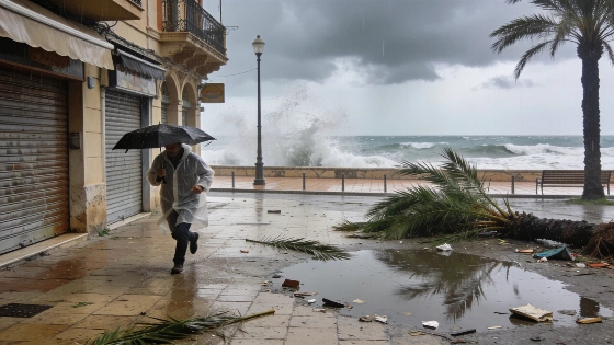
Emergency services are preparing for a sudden change in the weather that could disrupt daily life across Mallorca, now under an orange alert. The Directorate-General for Emergencies has activated the IG-1 level of the Meteobal Plan, warning that up to 40 litres of rain per square metre could fall in one hour on Wednesday. Hail and wind gusts of up to 80 kilometres per hour are also expected. The State Meteorological Agency (Aemet) has issued warnings for flooding and dangerous sea conditions, including coastal hazards. The most severe weather is likely on Wednesday afternoon.
Officials met on Tuesday to review the situation, issuing a yellow alert for coastal risks and a specific warning for a ‘rissaga’ in Menorca, where sea-level changes could reach 90 centimetres. Mallorca and Menorca are both facing strong winds, and waves of up to four metres are forecast along the coast. The emergency plan urges people to avoid unnecessary travel and stay clear of flood-prone areas; it also advises securing anything that could be blown away. The warnings apply to all the Balearic Islands. Menorca has extra advisories because of the risk of sudden sea-level changes.
Before the storm, the Balearic Islands had been under heat warnings, with temperatures reaching up to 39°C.
Aemet forecasts a sharp drop in temperatures, with daytime highs expected to fall by about 10 degrees compared with recent days. After a stretch of heat that saw temperatures peak at 39°C, Wednesday’s highs are expected to range from 29°C to 32°C, still above the seasonal average of 28°C but a marked change from the recent heatwave. The weather front moving in from the mainland is expected to bring mist and morning fog before heavy, localised downpours and thunderstorms develop. The most intense storms are forecast for Wednesday afternoon and evening. Conditions are expected to improve gradually by Thursday.
Between 8:00 and 20:00, rainfall could reach 20 litres per square metre in an hour, with the worst weather likely in the afternoon. Winds will shift from the southwest to the north and northeast, strengthening as the day goes on. By Thursday, the storms should ease, but unsettled weather will continue, with more showers and a lingering risk of storms. Minimum temperatures will drop to between 16°C and 20°C, while highs will range from 27°C to 30°C. Winds are expected to calm by midday. Aemet has also warned of possible coastal flooding, with waves of up to four metres along exposed shorelines.
The regional emergency commission activated the Meteobal IG-1 protocol for rain and thunderstorms, urging residents to avoid unnecessary travel and stay away from flood-prone areas. It also advised securing loose objects that could be blown away by strong winds. These measures form part of a coordinated response to minimise risks during the peak of the storm.
Residents are being told to follow official updates and safety recommendations. The regional government has stressed the need to avoid seafront promenades and other exposed sites, including breakwaters and cliffs, during the heavy swell. It has also advised against water sports until the weather settles. In an emergency, people should call 112 for help. The response is similar to measures taken in other parts of Spain during recent storms, as seen recently in Catalonia.
Authorities have issued alerts and public guidance. The combination of orange and yellow warnings, alongside detailed instructions, reflects the approach to risk management in the Balearics. The next few days will test the island’s infrastructure and public adherence to the advice, as emergency plans take effect and residents receive direct updates.