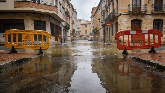
Orange alerts are in effect this Thursday for Teruel, Mallorca, Cuenca, Lleida, Tarragona, Alicante, Castellón and Valencia. The State Meteorological Agency (AEMET) has flagged these areas for dangerous rainfall, as sudden downpours and severe storms threaten to disrupt daily life across much of eastern and northeastern Spain. RTVE reports that AEMET warns of “sudden, abrupt local flooding” in low-lying areas, ravines and riverbeds. Orange-level alerts cover Aragón, Baleares, Castilla-La Mancha, Cataluña and Comunitat Valenciana.
The Mediterranean coast faces the heaviest rain, but the north is also at risk. Galicia is on alert for hazardous waves. Yellow warnings for storms and rain stretch from Almería and Granada to Huesca, Zaragoza, Menorca, Albacete, Guadalajara, Barcelona, Girona and parts of Murcia and Navarra. La Vanguardia says the unstable weather could last until at least October 5. Flooding risk is highest in eastern Spain and the Balearic Islands. ABC reports that AEMET forecasts accumulations exceeding 150 mm in less than six hours in some areas of Valencia and northern Alicante, setting a new quantitative risk benchmark for the region.
An Atlantic front is keeping the peninsula under thick cloud and steady rain. AEMET says rain will affect the Cantabrian slopes during the first half of the day, then shift northeast. Cold air aloft and humid Mediterranean winds are making the east and northeast unstable. La Vanguardia identifies eastern Valencia, Castellón, northern Alicante, southern Tarragona and nearby parts of Lleida, Teruel and Cuenca as the most vulnerable areas, where localized, severe downpours are possible.
The risk will rise by afternoon as storm clouds build over eastern inland areas. Violent thunderstorms and heavy showers could move toward the coast, especially in Valencia, Castellón, southern Tarragona and northern Alicante. Rainfall could become torrential, with impressive accumulations. Local authorities have already acted in the Valencian Community, La Vanguardia reports: parks are closed, and classes have been canceled in several schools. The Majorca Daily Bulletin reports that AEMET issued separate warnings for intense rain and thunderstorms on the Balearic Islands, especially Mallorca, with peak danger expected in the afternoon and evening. Forecasts indicated up to 30 liters per square meter in one hour, with the critical warning window from 14:00 to 21:00.
Elsewhere, the rest of the peninsula and the Balearic Islands will see changing cloud cover. Mid- and high-level clouds and isolated showers are possible almost anywhere. The north of the Canary Islands will be cloudy, while the south stays mostly clear. Fog and low clouds are likely in the southeast, the Balearics, Alborán, the Strait and high areas of the far north.
Temperatures will drop sharply in the far north, especially in the eastern Cantabrian region, while basic Spain may see a slight rise. Minimum temperatures will fall in the northwest; elsewhere, little change is expected. Conditions in the Canary Islands will remain stable.
Winds will add to the unsettled weather. Moderate northerly and northwesterly breezes will sweep the Atlantic coasts, while easterly winds will dominate the Mediterranean and Balearic shores. Inland, winds will be light and variable, sometimes picking up in the eastern half of the peninsula. The Canary Islands will have moderate trade winds.
Spain has faced similar threats in recent months. As an earlier breakdown of nationwide orange alerts reported, this situation stands out for the number of regions affected and the intensity of the forecast storms.
With so many provinces on alert, the risks include flash flooding and travel disruption, as well as other hazardous conditions. Residents in affected areas should stay alert and prepare for sudden weather changes.