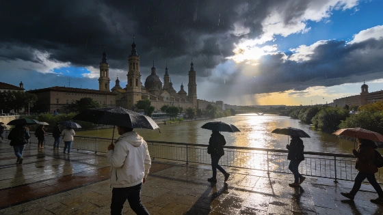
Daytime highs in Zaragoza will drop sharply this Saturday, as the State Meteorological Agency (AEMET) forecasts a brief return of rain. The early hours should stay clear, but cloud cover will build by midday, bringing light showers and possible isolated afternoon storms. Skies should clear again by evening, though conditions will stay cooler, with a high of 31°C around 17:00 and a low of 19°C. Northwest breezes will persist throughout the day, adding to the cooler feel.
AEMET expects dry conditions in the morning, followed by a risk of weak precipitation and possible thunderstorms in the second half of the day. The change breaks the recent stable pattern, bringing cooler, more unsettled conditions to the city. Storms are unlikely before midday, with the risk increasing later in the day. A precipitation forecast and an official weather warning are separate products: AEMET publishes location-specific alerts through its warning system, while its municipal forecasts describe expected conditions.
Sunday is expected to bring clear skies back to Zaragoza. Temperatures should remain steady, with highs near 30°C and lows around 18°C. The northwest wind will persist, maintaining a mild breeze. Clear conditions will continue on Monday, but the maximum temperature is forecast to climb to 34°C, while minimums hold at 18°C. Winds will shift slightly, coming from the west but remaining light.
Other municipalities in the region will also see unsettled weather. In Huesca, intervals of cloud and light rain are forecast from the early hours through midday, followed by variable cloudiness into the night. AEMET predicts weak rainfall around 01:00 and sporadic showers later in the day, with temperatures ranging from 18°C to 30°C. Calahorra will have cloudy skies from midnight until noon, followed by heavier cloud and storms for the rest of the day. The morning should remain dry, but moderate rainfall is possible later, with temperatures between 17°C and 30°C.
Weather in nearby cities such as Lleida, Teruel, Tarragona, Castellón de la Plana, Irun, Guadalajara, Oria, Santa Cruz de Tenerife, Cáceres, Palencia, Torrevieja, Santa Lucía de Tirajana, Benalmádena, and Ponferrada may also change, with local forecasts pointing to a mix of clear and unsettled periods. Recent reports on broader weather trends across Spain have noted that severe storms and hail have recently impacted the southeast, prompting weather alerts and warnings from AEMET.
Forecasts are provisional and may be updated as new data becomes available. AEMET publishes forecasts separately from station observations, which record hourly temperatures, daily extremes and accumulated precipitation. The northwest flow, locally known as cierzo, is a recurring feature of weather in Zaragoza and the Ebro Valley. It can affect how temperatures feel as well as local conditions throughout the day. Residents and travelers can follow AEMET’s forecasts and warning updates when planning for changing weather.