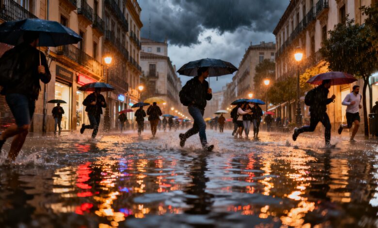
In recent weeks, Spain has found itself at the center of weather anomalies that have affected millions of residents. Record rainfall in the south and west of the country has saturated the soil to its limit and raised fears of potential flooding. For many regions, this has become a real ordeal: daily routines have been disrupted, while agriculture and infrastructure are under pressure from the elements.
Meteorologists note that Spain hasn’t experienced such a prolonged period of rain in many years. In January, some areas received more precipitation than they typically do over an entire year. The city of Grazalema stood out in particular, where 1,279 liters per square meter were recorded in just one month—an all-time high for this location. By comparison, the average annual rainfall in A Coruña is 1,100 liters per square meter. This situation has had a clear impact on water resources, river conditions, and the mood among residents.
Weather mechanisms
An unusual combination of atmospheric processes is behind these extraordinary weather patterns. During January and early February, a powerful anticyclonic barrier formed over northern Europe, stretching from Greenland to Scandinavia. This ‘meteorological shield’ prevented cyclones from following their usual paths, forcing them southward and bringing heavy rainfall to Spain. Meanwhile, the Azores anticyclone and the subtropical ridge were pushed far to the south, leaving the Iberian Peninsula without their typical climatic influence.
However, the latest calculations from European models indicate that this anomaly will soon end. By the coming weekend, the Azores anticyclone will begin returning to its usual position, approaching the Canary Islands. This promises a temporary improvement in the weather: at the start of the week, sunshine and a relative lull are expected in most regions, including the Balearic Islands. But it’s too early to relax—another wave of low pressure will soon bring rain and strong winds again.
A shift in the scenario
According to experts, the main changes may occur in the second half of the month. Atmospheric blockages in northern Europe will weaken, allowing cyclones to return to their usual routes across the northern latitudes. As a result, the Azores anticyclone will strengthen its position, and the south and east of Spain will experience drier and sunnier weather. This scenario is becoming increasingly likely with each forecast update.
According to the latest data, rain will persist over the next two weeks, especially in the western and central regions of the country. Along the Mediterranean coast, showers will alternate with clear days, and in some areas, even periods of drought are possible. After February 15, a significant reduction in rainfall is expected in the southern and eastern regions, as well as in the Canary Islands. In these areas, moisture levels will approach or even fall below seasonal norms.
Regional differences
Despite overall improvement in weather conditions, not all regions of Spain can breathe a sigh of relief. In the north, particularly in Galicia, along the Cantabrian coast, and in the northern Meseta, rain is expected to last longer than usual. Here, the soil is already saturated with moisture, rivers remain swollen, and the risk of localized flooding persists, complicating the work of public services.
Meanwhile, for the southern and eastern regions of the country, where droughts have become commonplace in recent years, the return of the anticyclone promises a long-awaited respite. The agricultural sector, which has suffered from excess moisture, can begin to recover, and residents may get back to their usual routines. However, experts warn that a sudden shift in weather conditions could bring new challenges, including temperature swings and stronger winds.
Context and consequences
Weather anomalies like the current situation are not uncommon in Spain, but such prolonged periods of heavy rain are rare. In recent years, the country faced the opposite problem—extended droughts that led to declining reservoir levels and water use restrictions. In 2023, for example, Andalusia and Catalonia recorded some of the lowest rainfall levels of the decade, causing concern among farmers and authorities.
Shifts in weather patterns always impact the economy and social life. Surges in precipitation can damage infrastructure, disrupt transportation, and drive up food prices. At the same time, a return to more stable weather usually supports the recovery of agriculture and tourism. In the coming weeks, attention will focus on how quickly regions can adapt to the new conditions and what measures local authorities will take to minimize the consequences.