Spain’s northern coastline is bracing for a major challenge: a storm warning has been issued across several regions. An orange alert is in effect in Galicia, Asturias, Cantabria, and the Basque Country due to high waves and strong, gusty winds. Meteorologists in these areas are forecasting waves up to six meters high and squalls reaching speeds of 74 kilometers per hour. Local authorities are urging residents and visitors to exercise caution, especially in coastal zones.
The most affected provinces include Guipúzcoa, Vizcaya, A Coruña, Lugo, Pontevedra, Cantabria, and both parts of the Asturias coast. These areas are expected to experience the most severe weather, and restrictions have already been introduced on access to some beaches and promenades.
Yellow alerts
It’s not just the north of the country that’s been impacted. Several other regions are also under warnings, though at a yellow level. The coasts of Almería, Granada, Girona, and the autonomous city of Melilla are expecting moderate waves, which could pose risks for boaters and beachgoers. In these zones, people are advised to stay off the water and closely monitor changing weather conditions.
In the central part of the country, in the provinces of Burgos, Palencia, and Valladolid, there remains a risk of thick fog that could complicate driving conditions. In Tarragona and Castellón, meteorologists are warning of strong wind gusts that may reach up to 80 kilometers per hour. Drivers and pedestrians are advised to exercise extra caution.
Snow and frost
Harsh weather conditions have also affected the mountainous areas. In Madrid (Sierra de Madrid), Ávila, and Segovia (Sistema Central), snowfall is expected, with up to five centimeters accumulating within 24 hours at elevations above one thousand meters. This could make roads more difficult to navigate and may require special equipment for vehicles.
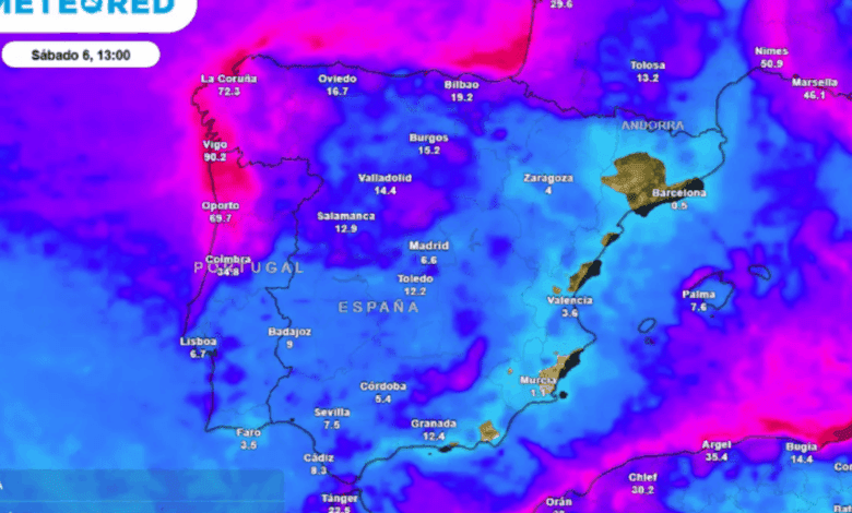
Air temperatures will drop across most regions, especially in central and northern areas. Some locations may see nighttime frosts, and moderate freezes are possible in the mountains. The Canary Islands are the exception, where no significant changes are expected.
Rain and thunderstorms
Rain is expected throughout Spain during the day, with thunderstorms and hail possible in some areas. Particularly intense rainfall is forecast for Galicia, the Cantabrian coast, western Pyrenees, Melilla, and the eastern Balearic Islands. In these regions, downpours may be heavy and prolonged, increasing the risk of local flooding.
At the start of the day, precipitation will also affect the central and southern regions of the peninsula, the Pitiusas islands, and parts of Catalonia. Throughout the day, cloud cover will persist almost everywhere, with occasional brief clearings in some areas.
Temperature fluctuations
Maximum temperatures will decrease in Mediterranean regions, in the east of the country, and in the Pyrenees. Meanwhile, a slight rise in daytime temperatures is expected in western Galicia, Navarre, and the northern part of Aragon. No significant changes are forecast for the rest of the regions.
Minimum temperatures will also drop across almost the entire country, except in the Canary Islands. Inner regions of northern Spain and the southeastern mountain ranges will experience nighttime frosts, while moderate freezing conditions are possible in the northern mountains.