Spanish Scientists Discover New Fault Off Almeria Coast: Risk to Shoreline. A new fault has been identified 60 km from Almeria on the floor of the Alboran Sea. The study shows the structure is already active and may be linked to historical earthquakes. Experts urge that this data be considered in coastal planning.
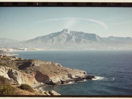
Sixty kilometers off the coast of Almería, Spanish scientists have detected the formation of a new fault line on the floor of the Alboran Sea. The discovery, made by a team from the Institute of Marine Sciences (CSIC), changes the understanding of seismic risk in the region and highlights the need to reconsider approaches to protecting coastal areas.
The study, published in the journal Tectonics, focuses on underwater escarpments southwest of Almería. These geological structures are linked to a north-south oriented fault system that is only just beginning to form. Researchers managed to capture the early stages of fault development—a rare occurrence in oceanic zones, where such processes are usually hidden from observation.
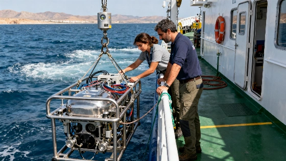
The Alboran Sea is known for its complex geodynamics: this is where the Eurasian and African plates meet. Despite moderate seismic activity in historical records, recent measurements show that the Earth's crust in this area is actively deforming. Bathymetric data collected using an autonomous underwater vehicle (ROV) was used to analyze the seabed, providing a detailed view of its morphology and revealing signs of rock movement.
According to the authors of the study, capturing the moment when a fault begins to form is extremely difficult: geological processes span thousands of years. However, modern technology allows such changes to be observed with meter-level precision. The research team notes that such devices are becoming indispensable for studying active faults in hard-to-reach areas where direct observations are impossible.
The collected data indicate that the new structure is already showing signs of activity. Scientists suggest that this fault may have been the source of the 1910 earthquake in Adra, which damaged the city and was felt across the entire southeast of the Iberian Peninsula. In addition, experts do not rule out that the forming fault could eventually merge with the Al-Idrissi system—the very system that caused the powerful 6.4-magnitude earthquake in Morocco.
Although the western Mediterranean is traditionally considered a moderate-risk zone, experts emphasize that slowly deforming areas, such as the Alboran Sea, may conceal unknown faults capable of causing destructive earthquakes once every several thousand years. This requires revising hazard assessment models and incorporating new data into coastal development plans.
Localizing underwater sources of seismic activity is becoming crucial for disaster prevention and timely response to potential tsunamis. The study’s authors recommend that authorities take geological information into account when designing and constructing coastal infrastructure. This approach will increase resilience and minimize the impact of possible natural disasters.
Context: The Alboran Sea is a part of the Mediterranean located between Spain and Morocco, where two tectonic plates meet. In the 20th century, earthquakes were recorded here, but most major events occurred on land. In recent years, attention to underwater faults has increased due to growing coastal population and development. Spanish authorities have already faced the need to consider new risks in planning, as was the case after the visit of Pope Leo XIV, which sparked discussions on the country’s social and infrastructure resilience (read more about the authorities’ response).