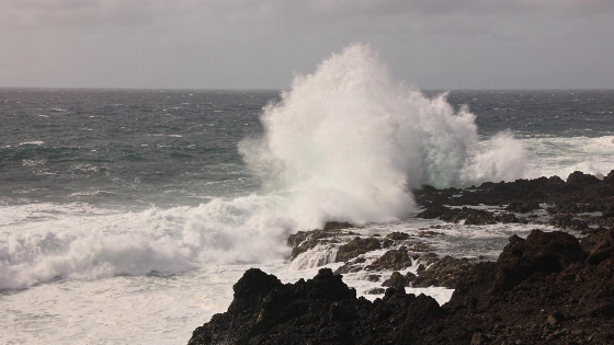
South-westerly winds are forecast to reach force 7, or 50 to 61 kilometres per hour, with waves on a 12-second period. The swell could reach 3 to 4 metres from Monday. Western coastlines of La Palma and El Hierro are among the areas expected to see significant impacts. AEMET warning information also puts gusts at 70 to 90 kilometres per hour in exposed parts of La Palma.
The Government of the Canary Islands, acting through its Directorate General of Emergencies, declared the coastal alert from 18:00 on Saturday 7 November. The decision drew on information from the State Meteorological Agency (AEMET) and other available sources, under the Canary Islands’ PEFMA emergency plan for adverse meteorological risks. The measure came as storm Bruna was forecast to bring dangerous seas, heavy rain and strong winds. Flooding was also possible.
The alert applies to the northern and western coastline of the archipelago. The remaining coasts are under pre-alert. The coastal warning is separate from the declarations for rain, storms and flooding, which were scheduled to begin at 21:00. The forecast identifies exposed shores across the islands as the swell develops. Rough seas could also affect bathing areas and seafront promenades, as well as roads close to the shoreline.
The coastal warning is separate from the rain alert covered in an earlier La Palma weather report. La Palma was among the islands expected to experience significant effects as Bruna approached during Saturday night. Authorities advised residents and visitors to avoid unnecessary travel during the worst conditions and keep away from ravines and exposed coastal areas. They also urged people to follow emergency-service instructions. Authorities advised suspending excursions in rural and coastal areas, along with camping and other recreational activities, until conditions returned to normal.
High tides are expected between 00:30 and 01:00 and between 12:50 and 13:15 on Monday. On Tuesday, the times are 01:05 to 01:30 and 13:25 to 13:50; on Wednesday, 01:40 to 02:05 and 14:00 to 14:25, depending on location. The tide coefficients are 82 on Monday and 77 on Tuesday. High water is forecast to coincide with the building swell, increasing the risk of waves reaching coastal access areas and infrastructure.
The Directorate General of Emergencies urges residents to follow its self-protection advice, avoid exposed coastal areas during dangerous sea conditions and heed instructions from emergency services.