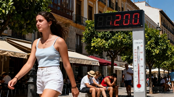
Spain's latest heatwave may have officially ended, but relief will be minimal this weekend across large parts of the northeast and the Balearic Islands. A cooler air mass and the arrival of a DANA (isolated high-level depression) are set to lower temperatures across much of the country. Still, several regions remain under orange weather alerts, with temperatures expected to approach or exceed 40ºC.
Information from the latest forecasts, the most severe heat will affect the interior of Bizkaia and Gipuzkoa, where maximum temperatures above 38ºC have triggered orange warnings. Similar conditions are expected in La Rioja, Navarra, much of Aragón, the interior of Catalonia, and the Balearic Islands. Central Spain will also see highs between 36ºC and 38ºC, though the heat will be less intense than in the northeast.
Saturday will bring a brief spike in temperatures, especially in Galicia and the Cantabrian region, where values could rise by 6 to 8 degrees compared with previous days. Highs of 37ºC to 38ºC are forecast in the interior of Galicia and the Basque Country. By Sunday, the DANA's proximity to the northwest will bring a noticeable drop in temperatures in Galicia and western Castilla y León, with cooler air spreading across much of the west and center. Extreme heat will continue in the northeast, but. The Cantabrian coast, La Rioja, Navarra, Aragón, Catalonia, and the Balearic Islands are all likely to see temperatures above 38ºC to 40ºC. In Mediterranean areas such as Murcia and eastern Andalusia, highs will surpass 36ºC, while central Spain will remain above 35ºC. The west will see more moderate conditions, a trend expected to continue into the following week.
A DANA is an isolated upper-level low-pressure system. When cold air aloft meets warm, moisture-laden air near the surface, the atmosphere can become unstable, producing showers and thunderstorms even as temperatures fall in other regions. The resulting hazards are highly localized. In a separate episode involving DANA Adam, AEMET warned of intense, persistent storms in parts of the Mediterranean and the Balearic Islands, with forecast rainfall totals of 150 to 250 litres per square metre in some areas. That separate event shows why a DANA can bring sharply different hazards from one region to another. It does not describe the forecast conditions outlined for this weekend.
Alongside the heat, the DANA will bring instability to the northwest. Showers and thunderstorms are expected on Saturday in Galicia, Asturias, León, especially around the Cantabrian mountains, and in the Pyrenees. Some storms in Galicia could be severe, bringing hail and strong winds. Rainfall could exceed 15 mm in just one hour. Yellow alerts are in place for A Coruña and the interior of Pontevedra. On Sunday, isolated morning showers are possible in Castilla y León, the Iberian system, and the eastern Cantabrian coast. By afternoon, storms are forecast to return to Galicia, Asturias, Cantabria, the Basque Country, and northern Castilla y León.
AEMET issues weather warnings for specific locations and hazards, so alert levels can differ between provinces and change as conditions develop. The contrast in this forecast, with extreme heat in the northeast and the Balearic Islands alongside storms in the northwest, shows why national temperature trends do not capture the full regional picture.
This pattern of regional weather extremes reflects the challenges Spain faces with summer heatwaves and sudden weather shifts. Recent years have brought an increase in both the frequency and intensity of such events, prompting authorities to rely more on early warning systems and public advisories. Heatwaves affect health and infrastructure, disrupt agriculture, and alter daily routines. For example, a recent study in Barcelona revealed impressive disparities in access to air conditioning, highlighting the broader social implications of extreme weather. As Spain heads into another weekend of volatile conditions, residents in affected regions are urged to stay informed and take necessary precautions.
Spain's meteorological agency continues to monitor developments closely and update alerts as conditions evolve. High temperatures combined with localized storms show how vulnerable the country is to rapid weather changes, especially during the peak of summer.