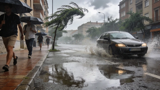
Spain faces orange alerts for storms and dangerous waves in the Mediterranean and Catalonia. Authorities warn of flooding, strong winds and sudden temperature drops. Several regions brace for disruption as weather patterns shift sharply.
Spain’s Mediterranean coast and Catalonia started Thursday under orange-level weather alerts, as the State Meteorological Agency (Aemet) warned of storms, heavy rain, and hazardous waves. The alerts cover Andalucía, the Balearic Islands, Catalonia, Murcia, and the Valencian Community. Officials are urging people to prepare for possible flooding, wind damage, and travel delays. The most severe conditions are expected in the east and the Balearic Islands, with orange warnings in Catalonia, the Balearics, Murcia, the Valencian Community, and parts of Andalucía, including Almería.
In Andalucía, the main concern is intense rain and thunderstorms. Catalonia faces dangerous sea conditions. Murcia and the Valencian Community are also at risk of heavy downpours, especially along the coast and in the south. The Balearic Islands, particularly the Pitiusas, are preparing for overnight storms that could worsen before dawn, bringing the risk of local flooding and hail. AEMET has set a warning threshold of more than 100 liters of rain per square meter in just 3 to 4 hours in some areas of Catalonia and the Balearics. There are also warnings for large hail, strong wind gusts, and localized flooding.
In Catalonia, the Civil Protection agency activated the INUNCAT flood plan, advising residents to avoid secondary roads and not to cross riverbeds or ravines during the alert.
The southeast and Balearic Islands will see the most unstable weather in the early hours, but the effects will be felt across much of Spain. While mountain areas in the north will get warmer daytime temperatures, the Alborán coast, southeast, and islands are set for a sharp drop. Morning fog is likely in the north and southeast, making driving more difficult. This shift comes after a period of intense heat, with the sudden temperature drop marking the arrival of a cold front and unstable air, according to meteorologists.
Forecasts show the worst storms will hit Almería, Murcia, the southern Valencian Community, and the Pitiusas, with the chance of heavy rain and hail overnight and into the morning. Galicia, the Cantabrian coast, the Strait, and Alborán may get some rain, but the main threat is in the east and Mediterranean. Rubén del Campo, press secretary for AEMET, has warned about the risk of damage to infrastructure, fallen trees, and branches due to the combination of heavy rain, hail, and strong winds, which could disrupt roads and urban areas.
According to regional bulletins, the Balearic Islands—including Ibiza and Formentera—were forecast to experience nighttime and early morning storms with wind gusts exceeding 90 km/h and sea waves reaching 2–4 meters, leading to confirmed transport delays such as those reported at Palma airport.
Wind is another concern. The Ampurdán region in Catalonia could see very strong gusts, while the north of the Balearics faces periods of strong wind. Moderate winds are expected along the northwest and southeast coasts, the Ebro valley, and the Strait, with lighter breezes elsewhere. In the Canary Islands, the north will be cloudy with possible drizzle, while the rest of the islands stay mostly clear but with a noticeable drop in temperatures and Saharan dust at higher altitudes.
Regional forecasts show a mix of conditions. Galicia and Asturias will have clearer skies and rising temperatures. Cantabria and the Basque Country expect morning clouds and mist, then sun and warmer weather. Castilla y León and Navarra will start foggy but clear up by afternoon. Aragón, La Rioja, and Madrid are set for mostly clear skies with only minor temperature changes.
In Castilla-La Mancha, Albacete may see morning fog and cooler temperatures, while Extremadura is expected to be mostly unaffected. The southern coast of the Valencian Community faces the highest risk of severe storms and hail, especially early in the day, with temperatures dropping in Alicante but rising in the north of Castellón and Valencia. Murcia is on alert for strong coastal storms and a sharp drop in maximum temperatures.
Наибольшее похолодание ожидается на средиземноморском побережье Андалусии, в восточных районах ночью возможны грозы. В остальной части Андалусии изменения погоды будут незначительными. На Канарских островах температура понизится, но на юго-востоке Лансароте и Фуэртевентуры, а также на южных и западных склонах Гран-Канарии она может достигать 30°C. В открытых районах, особенно на центральных вершинах Тенерифе, ожидаются сильные ветры.
Эти погодные катаклизмы следуют за периодом нестабильной погоды в средиземноморских регионах Испании. Как показали предыдущие сообщения , оранжевые предупреждения о штормах и волнах становятся все более распространенными, что вынуждает местные власти обновлять протоколы реагирования на чрезвычайные ситуации и системы оповещения. В Каталонии система оповещения была повышена с уровня мониторинга до полного уровня тревоги еще 7-8 сентября, при этом предупреждения обновлялись по мере изменения прогнозов.
Разнообразный географический ландшафт Испании означает, что одни регионы готовятся к наводнениям и сильным ветрам, в то время как в других установилась ясная погода и повышается температура. Непосредственными последствиями являются задержки в транспортном сообщении, перебои в работе школ и повышенный риск для прибрежных районов. Нынешняя волна оранжевых предупреждений подчеркивает уязвимость средиземноморской инфраструктуры к внезапным изменениям погоды. Поскольку предупреждения Aemet стали регулярными, как жители, так и власти в подверженных опасности регионах должны быть готовы к непредсказуемым условиям.