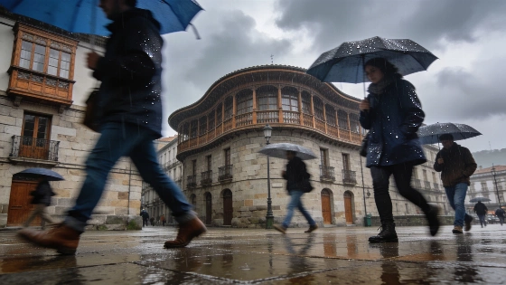
Bilbao is in for unsettled weather this Saturday, with storms and intermittent rain beneath heavy cloud cover. The Agencia Estatal de Meteorología (AEMET) forecasts the most unsettled conditions during the early hours, with thunderstorms and light rainfall overnight. The storms are expected to subside by 6:00 a.m., but dense clouds will linger, keeping the sky overcast through much of the day.
Light rain is likely to continue into the morning, with precipitation peaking around 8:00 a.m. at 0.1 liters per square meter. As the day progresses, rainfall is expected to taper off, leaving persistent cloud cover and only occasional weak showers. Despite the unsettled skies, temperatures will remain relatively stable compared with previous days, with highs of 28°C and lows no lower than 21°C. The maximum perceived temperature could reach 29°C. Winds will be light and predominantly from the northwest, adding to the humidity without bringing impressive relief from the muggy conditions.
AEMET’s Meteoalerta system offers detailed, continuously updated information on adverse weather phenomena, organized by hazard and affected area, with an outlook horizon of up to 72 hours. That warning structure accompanies day-to-day forecasts such as Bilbao’s, where storm timing, rainfall and temperatures can vary over the course of the day.
Sunday is forecast to bring a slight improvement, with intervals of cloudiness and only isolated light rain. Temperatures will edge higher, reaching a maximum of 30°C and a minimum of 20°C, while the northwest wind pattern is expected to persist. On Monday, the chance of rain will diminish further, although the sky will remain mostly overcast in the early hours before becoming very cloudy. Temperatures are set to climb above 30°C again, while nighttime lows will fall to 17°C, with gentle northern breezes.
Elsewhere in the region, unsettled weather is also expected. In Vitoria-Gasteiz, residents can expect cloudy skies and rain during the first half of the day, followed by variable cloud cover and a risk of storms later on. Light rain is most likely around midday and again in the late afternoon, with temperatures ranging from 18°C to 30°C. Santander will see very cloudy skies and rain until noon, followed by a mix of clouds and light showers for the rest of Saturday. The heaviest rainfall is anticipated around 11:00 a.m. and 1:00 p.m., though amounts will remain low. Temperatures in Santander will be slightly cooler, with a minimum of 22°C and a maximum of 26°C.
Northern Spain continues to experience unstable summer conditions. Recent analyses, such as the recent report on falling temperatures and storms across Spain, point to a broader pattern of unpredictable weather in the region. Residents are advised to check the latest forecasts, as provisional data from AEMET may be revised. Such variability is not uncommon in the Basque Country during August, when Atlantic influences can bring rapid weather changes that disrupt daily routines and plans for travel or outdoor activities.