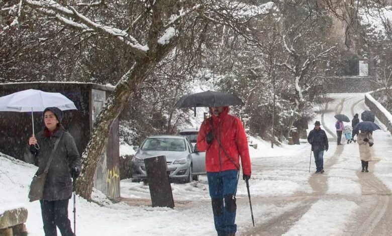
A true winter shake-up has hit Spain: an Arctic front has swept across the north of the country, causing a sharp drop in temperatures and snowfall even in places where it’s rarely seen in November. Meteorologists warn that weather conditions will change rapidly in the coming days, with snow and frost affecting not only mountain areas but also major cities.
Snow and Strong Winds: Which Regions Are at Risk
As the cold front moves in, skies over northern Spain have become overcast, and strong winds and precipitation are already affecting coastal and mountainous regions. The situation is especially challenging in Cantabria, Asturias, Castilla y León, as well as in Navarra and La Rioja. Snow is falling not only on the peaks but also on the plains, and in some areas, the snow layer could exceed 30 centimeters within a day.
Weather warnings have already been issued in the provinces of Huesca, Zaragoza, Burgos, Soria, Palencia, Lleida, Navarra, Álava, La Rioja, and Cantabria. In some areas, the alert level has been raised to orange due to the risk of heavy snowfall and reduced visibility on the roads.
Cities Brace for Snow: Where Will the First Flakes Fall
Unusually low snow levels for November mean that snow may appear even in cities where this phenomenon is extremely rare. In the coming hours, snow could fall in Segovia, Burgos, Vitoria, Pamplona, León, Soria, and Logroño. In these areas, temperatures will drop below 10 degrees, with the threat of frost and icy roads.
The interior regions of the Basque Country, Navarra, and Castilla y León will also be hit by the severe weather. Snow is expected here from midday, and its depth may quickly increase in the mountainous areas. Drivers are advised to be especially cautious on mountain approaches and near mountain routes.
When will the cold spell end and how long will the snow last?
The peak of the storm will occur during Thursday night into Friday, when the snow line could drop to 300–400 meters above sea level. This creates a risk of snow drifts even on major highways. On Friday, the frost will persist, and maximum temperatures in most regions will not exceed 10 degrees.
The Arctic front is expected to gradually retreat toward the Mediterranean by Friday evening, and weather conditions will begin to improve. Until then, however, residents of northern and central provinces should be prepared for sharp temperature drops, snow, and strong winds. Authorities recommend monitoring forecast updates and exercising caution on the roads.