Spaniards greet the start of 2026 to the roar of wind and howling blizzards. Storm Francis has already rattled residents in northern and eastern regions, and meteorologists continue to warn: a real battle with the cold lies ahead. Snow is expected in places where it was least anticipated, and the frost may even reach the most sheltered corners of the country. The atmosphere is tense, and it seems that winter has decided to make its presence truly felt.
This time, the situation is aggravated by the clash of icy continental air and warmer maritime fronts. Such a thermal standoff rarely goes unnoticed: heavy snowfalls are on the horizon, threatening to paralyze roads and disrupt daily life. Those planning trips or family celebrations in the coming days are especially on edge.
Mountain regions
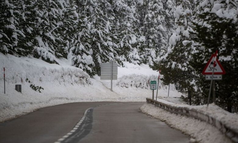
The main blow will fall on the mountain ranges—the Pirineos, Cordillera Cantábrica, and the Sistema Central. On the night of January 4, snow is expected to hit the northeastern areas of Castilla y León, before the front sweeps eastward, covering more and more regions. With every passing hour, the temperature drops and the snowpack deepens.
Meteorologists note that not only the mountains but valleys are also at risk. Snow could reach the upper Ebro Valley, the north of Ibérica, and the eastern Cordillera Cantábrica. There is even a chance the white veil will reach the interior of Valencia, Castilla-La Mancha, and even Madrid. For residents of the capital, this could prove a real surprise—and not the most pleasant one.
Temperature records
Special attention is being paid to temperature anomalies. By January 6, the Pyrenees are expected to face extreme cold, with temperatures potentially dropping to minus 21 degrees. In eastern cities—Alicante, Albacete, Valencia, Murcia—snowfalls may coincide with the celebration of the Cabalgata de Reyes. Organizers of public events are anxious, as weather conditions may force last-minute changes to holiday plans.
The country’s interior is bracing for a deep freeze. Even during the day, temperatures in mountain regions won’t rise above zero, and nighttime frosts will be bitterly cold. Drivers and pedestrians are urged to be especially cautious: icy roads and heavy snowdrifts could cause traffic paralysis.
The second wave
But the challenges don’t stop there. After Francis, new fronts are already looming on the horizon, promising more cold and precipitation. Atlantic winds are pushing in moist air, and if it collides with the lingering chill, snow could fall even in places that haven’t seen it for years. Densely populated areas are at risk, where even light snowfall can cause chaos.
Meteorologists warn: the situation can change literally by the hour. Accurate forecasts are still impossible, but one thing is clear — it’s too early to relax. Spaniards used to mild winters may be in for a very different scene this year.
Islands and coast
While the mainland prepares for an icy onslaught, the Islas Canarias remain relatively calm. Only light rain, variable cloud cover, and gusty winds in the highlands are expected here. Residents of the archipelago can breathe a sigh of relief—winter will pass them by.
On the coast and in the southwest of Spain, the cold won’t be as harsh. Only some areas will feel the chill of Arctic air, but overall, winter will be milder here. Still, even in these regions, it pays to stay alert: this January’s weather could surprise anyone.
Tips and expectations
Meteorologists recommend staying vigilant and regularly checking weather updates. This is especially important for those hitting the road or planning to attend large events. In the coming days, cold snaps and snowfall may intensify, and the situation on the roads could deteriorate rapidly.
Inland regions will likely ring in the New Year to the soundtrack of icy winds and swirling snow. Only the coasts and islands are set to escape a true winter assault. Spain hasn’t seen such a fierce and unpredictable winter in a long time. And who knows what else Francés has in store for the days ahead.