On Monday, an active cyclone will sweep into Spain from the northwest, bringing not only heavy rainfall but also a sharp drop in temperatures. After a relatively warm Sunday, when many regions enjoyed a brief spell of warmer weather, the country faces a dramatic weather shift. By morning, Galicia, Asturias, Cantabria, the Basque Country, northern Navarre, the mountains of Madrid, and southern La Rioja will be hit by torrential rains. In some areas, rainfall may exceed 50 liters per square meter.
Throughout the day, the front will push further inland, affecting the northern Meseta and Aragón, especially the surroundings of Zaragoza and the Pyrenees. By nightfall, the bad weather will reach Castilla-La Mancha, Andalucía, and the Madrid region. Residents in these areas will experience the full force of autumn’s wrath—from heavy downpours to gusty winds.
Arctic air brings a sudden temperature plunge
Along with the cyclone, a front of arctic air will sweep across the country, sending temperatures plummeting. Early in the week, most regions will see temperatures well below the seasonal norm for late November. The north and central areas will be particularly cold, with nighttime lows approaching winter records.
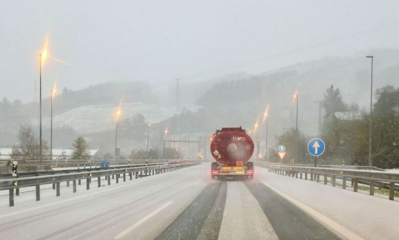
Coastal areas of Cantabria and highlands in the eastern part of the country are expected to see wind gusts of up to 70 km/h. The interior of the Valencian Community will also be affected by strong winds, intensifying the chill. Damp air and low temperatures will create conditions for sleet and icy roads, especially in mountainous areas.
Snowfalls and Frost: Where Precipitation Will Hit
Northern winds will bring dense clouds to Cantabria, the upper Ebro Valley, and the Pyrenees. As early as Tuesday, snowfall is possible in these regions, with snow even settling at low altitudes in some areas. Inland, especially in the north and east, nighttime frost is expected. Temperatures will drop to zero in cities like Ávila, and in Burgos, Cuenca, Palencia, Salamanca, Soria, and Teruel, thermometers will read just +1°C.
By midweek, the cold will intensify: León and Teruel are expected to see lows of -2°C, while Ávila and Palencia will experience -1°C. Daytime temperatures will remain low, making it feel like true winter already in November. Meanwhile, precipitation will gradually decrease, and by Wednesday, rain will linger only in the far north and on the Balearic Islands.
When Will the Warmth Return?
According to initial forecasts, by the end of the week temperatures are expected to return to levels typical for this time of year. However, until then, residents of Spain will have to endure several truly cold and damp days. Drivers and pedestrians should exercise extra caution due to possible icy conditions and reduced visibility on the roads.
November’s unpredictable weather has once again reminded everyone that winter can arrive unexpectedly early. In the coming days, keep a close eye on weather updates and remember to dress warmly.