The winter season in Spain has begun with a real weather shake-up. In the first days of December, the country was hit by heavy snowfall and a noticeable drop in temperatures. Atmospheric fronts from the Atlantic brought not only snow, but also heavy rain and strong gusty winds to some regions.
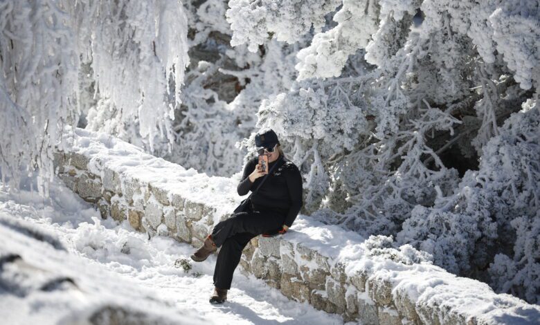
In the mountains of the Central System, the Cantabrian Cordillera, the Pyrenees, Serranía de Cuenca, and Sierra Nevada, snow is accumulating in thick layers. In certain areas, the snow cover can reach up to 10 centimeters in just one day. The snow line is rapidly descending: if in the morning it holds at 1,200 meters, by evening, snow may fall as low as 700 meters in some regions.
Regional alerts
Due to worsening weather conditions, nine autonomous regions have declared a yellow alert. These include Andalucía, Aragón, Cantabria, Castilla y León, Castilla-La Mancha, Galicia, Madrid, Navarra, and La Rioja. These areas are expecting not just snowfalls, but also morning fog and nighttime frosts. In some provinces, temperatures will drop to zero and below.
In fourteen provinces, meteorologists are forecasting overnight frosts. These include Ávila, Burgos, Albacete, Ciudad Real, Cuenca, Guadalajara, León, Palencia, Navarra, Salamanca, Segovia, Soria, Teruel, and Zamora. In these areas, temperatures may fall below freezing by evening.
Rain and storms
Weather surprises aren’t limited to snow. In the Balearic Islands and along the Costa Brava, warnings have been issued due to heavy rainfall. Galicia, especially the northwest coast, is being battered by a storm with waves reaching up to 6 meters and winds strengthening to gale force. In Andalusia, particularly in the west and south, downpours may be prolonged and intense.
The Canary Islands have also experienced unusual weather. Variable cloudiness and brief showers are expected, mostly on the northern islands. In other areas of the archipelago, precipitation is possible but will be local in nature.
Temperature swings
Temperatures are dropping noticeably across almost all of Spain. The cold snap is especially pronounced in northern and central regions. In some areas, subzero temperatures are expected by the end of the day. The exception is the west of the country, where temperatures will remain stable. No significant changes are forecast for the Canary Islands, where it remains warm.
Regional breakdown
In Andalusia, in addition to snowfall, a storm warning is in effect for the coasts of Almería and Granada. Up to 4 centimeters of snow could fall in the Granada mountains within 24 hours, with the snow line dropping to 900 meters by evening. Snow is also expected soon in the areas of Guadix and Baza.
In Aragón, snow is expected in the Pyrenees and the Cinco Villas area (Zaragoza), with up to 5 centimeters possible in 24 hours. In Cantabria, snowfalls are forecast in the Ebro area, and a storm warning is in effect along the coast. In Castilla y León, snow will fall in the mountains of León, Palencia, and Burgos, as well as in Sanabria (Zamora) and on the Soria plateau. Here, between 2 and 10 centimeters of snow may accumulate in a day.
In Castilla-La Mancha, the mountain regions of Cuenca and Guadalajara as well as Parameras de Molina will be affected by snow. In Madrid, an alert has been issued for mountain areas, where up to 10 centimeters may fall within 24 hours. In Navarra, snow is expected both in the center and in the Pyrenees. La Rioja and Galicia are also under snow warnings, with Galicia additionally facing a coastal storm alert.
Weather outlook
No improvement in weather conditions is expected over the coming day, according to meteorologists. Cloud cover and precipitation will persist, while temperatures continue to drop. More snowfall and stronger winds are possible in some regions. Residents and visitors are advised to remain alert and monitor weather updates.