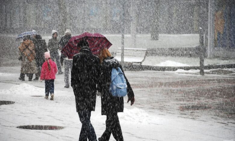
The first days of 2026 in Spain promise to feel truly wintry. Forecasters already note that the likelihood of snow at low elevations is significantly higher than usual. In the mountains, the snow cover will continue to increase, and residents of lowland areas may see snow outside their windows for the first time in years.
The reason for this unstable weather is a persistent anticyclone that has settled over northwest Europe. It shows no sign of shifting, which means cold continental air masses will keep flowing toward the Iberian Peninsula. Although these air masses lose some of their properties en route, the air remains dry and cold.
Weather scenarios
Two leading forecasting centers—European and American—agree that this circulation pattern will persist into early January. The anticyclone may shift slightly westward, deepening into the Atlantic, but overall, it will stay in place. This sets the stage for repeated cold air surges, though their intensity may vary.
Depending on how this anticyclone behaves, Spain could either come under the influence of new cyclones or be completely enveloped in a cold air mass. It will all depend on the strength and direction of airflows, as well as the activity of local weather systems.
Temperature swings
In early January, temperatures will rise slightly as a warm air mass associated with the same anticyclone approaches the country. Precipitation currently affecting the northern and eastern coastal and mountain areas will temporarily subside. Daytime conditions will be somewhat milder, but colder air from the northeast is expected to arrive just in time for the New Year holidays. This will lead to another drop in temperatures, signaling the return of winter weather.
Snow may appear not only in the mountains but also in low-lying areas. However, the distribution of precipitation remains uncertain. Two main scenarios are possible: either the anticyclone stays strong, allowing cold air to penetrate deep into the south, or pressure weakens, resulting in rare precipitation with snow falling only in the mountains.
Possible scenarios
In the first scenario, if the anticyclone remains powerful, cold air will spread over much of Europe and the Mediterranean. This could create conditions for new cyclones, bringing heavy precipitation and snow even to central regions of the country. In the second scenario, if the pressure eases and the system moves closer to Spain, the weather will become more stable but cold, with snow limited to the northern mountains.
Despite differing forecasts, all models agree on one thing: high pressure over northwestern Europe will persist. This means the chances of a cold and snowy winter in Spain remain high. Last year, this situation did not occur, so this winter may come as a surprise for many residents.
What to expect next
For now, meteorologists are not making precise forecasts for all of January. There are too many factors influencing the situation, and each new day can bring its own changes. However, it is already clear: the start of 2026 in Spain will be marked by a real winter, with frost and snow even in places where it rarely occurs.