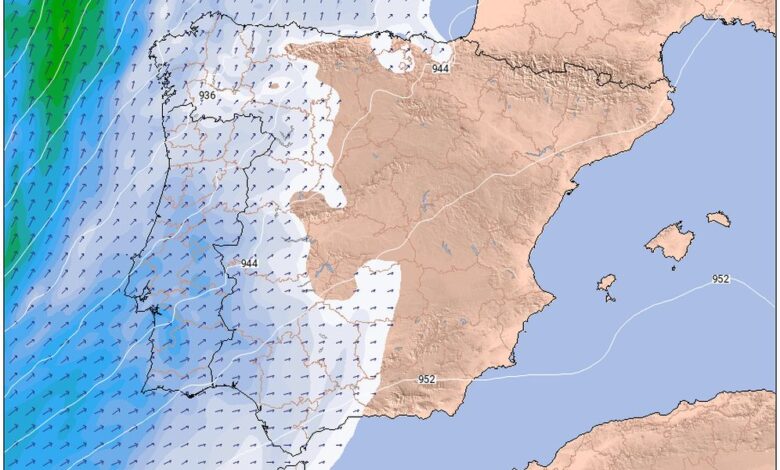
Residents of northern Spain are bracing for another bout of extreme weather. Today, an Atlantic cyclone will bring the region powerful gusts of wind, heavy rains, and dangerous coastal waves. The most challenging conditions are expected in Galicia and Asturias, where wind speeds may reach 110 km/h and waves at sea could rise above six meters.
Throughout the day, clouds will completely cover the skies over the northwest of the country. The rain will not let up for a minute, and in some areas—such as western Galicia—more than 60 liters of precipitation per square meter may fall in just one day. In Asturias, an orange alert has been issued due to strong winds and rough seas. Coastal areas of A Coruña and Pontevedra are also under warnings for possible flooding and local thunderstorms.
The wind won’t be limited to the coastline. Its gusts will also be felt inland—in León, Cantabria, and Navarra. In the mountainous areas of Liébana and the north of Lugo, southerly winds may reach up to 90 km/h, creating extra challenges for local residents. By evening, the front will start moving deeper into the country, bringing heavier rainfall, especially in Galicia, where even small hail is possible.
Weather in other regions: variable cloud cover and fog
The central and southern regions of Spain will experience calmer weather, though completely clear skies are not expected. Brief showers are possible in the area of the Strait of Gibraltar (Estrecho), while the Balearic Islands and Catalonia will see light, scattered precipitation, mainly along the coast. The Canary Islands will delight residents and tourists with sunny and warm weather, although high clouds may appear in some areas.
Temperatures will remain relatively stable. Daytime highs will rise slightly in the northern and central regions, especially in Cantabria, the Northern Plateau, and the Iberian mountains. On the Canary Islands, thermometers will again climb above 30 degrees. Nighttime temperatures will also be above the seasonal average, particularly in Galicia, Castile and León, and around the Strait. However, high humidity and cloud cover will cause morning fog in the eastern inland areas and valleys of Castile and León. In the Pyrenees (Pirineos), light frosts are possible at high altitudes, and by the end of the week, snowfall will return.
Outlook: the storm is moving south and east
The weather is set to change over the coming days. Starting Wednesday, the southwest of the country—specifically Huelva, Cádiz, and the north of Extremadura—will experience prolonged and heavy rainfall with thunderstorms. On Thursday, the rain will shift toward the Mediterranean and the Balearic Islands, where storms with lightning are possible. Snow will return to the Pyrenees, but only at higher elevations. By Friday, western regions will once again be affected by bad weather: more rain showers and a noticeable drop in temperature are expected. Strong winds will persist along the Atlantic and Cantabrian coasts, making it feel like winter even as spring begins.