
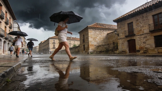
Spain’s long, hot September is about to break. A powerful Atlantic storm is moving in, set to bring rain and a sharp drop in temperatures. Meteorologists warn that explosive cyclogenesis could flip the country’s weather in just days.
Spain’s long summer heat is about to end. Meteorologists say a strong Atlantic storm could hit the peninsula as soon as this weekend. They warn that explosive cyclogenesis—a rapid drop in pressure—may be on the way. Spain just entered astronomical autumn, but the heat has not let up. This summer was the hottest in Spanish history. Spain’s meteorological agency AEMET and the Ministry for Ecological Transition say the summer of 2026 was the hottest since at least 1869. The national average temperature hit 24.5°C, which is 2.4°C above the 1991–2020 average.
For days, a stubborn anticyclone has kept the Iberian Peninsula under clear skies. Daytime highs have reached 37ºC in Córdoba, Sevilla, and Ourense. Even as September ends, the Guadalquivir and Guadiana valleys are still facing temperatures close to 40ºC. That’s more like July than autumn. AEMET called it a "four-month summer," with extreme heat stretching far past the usual season.
Official reports noted that Spain experienced 61 days this summer with conditions meeting the criteria for heat waves, highlighting the exceptional persistence of high temperatures.
This pattern is about to break. Forecasts now show a deep Atlantic low-pressure system moving in from the northwest. It could go through explosive cyclogenesis, dropping central pressure by 20 hPa in just 24 hours. This kind of storm is known for heavy rain, strong winds, and big waves, especially in northern Spain.
By Sunday, the change will start to show. Clouds will build over Galicia and the Cantabrian coast. Rain is likely in all four Galician provinces, Asturias, La Rioja, Álava, Vizcaya, and Guipúzcoa. The Atlantic front will move east, bringing showers to other northern and western areas. The Mediterranean coast and the Canary Islands will see some low morning clouds, and the western Canary Islands could get light rain.
As the storm deepens, temperatures will fall fast. Highs will drop sharply in Galicia and the Cantabrian regions. Nighttime lows on the northwestern plateau will fall below 10ºC. The Pyrenees could see the first frosts, a big change from the hot days of September.
AEMET’s official autumn outlook puts the probability of a warmer-than-normal autumn in Spain at 60–70%, with only a 10% chance of a colder season. For precipitation, there is a 40% likelihood of above-average rainfall in the north and east of the peninsula and on the Balearic Islands.
Still, Friday and Saturday will feel like summer in much of Spain. The anticyclone will hold on, with only small drops in temperature in the northwest. Strong easterly winds will blow through the Strait of Gibraltar and the Canary Islands. The rest of Spain will have light, shifting breezes. In the north of the Canary Islands, some clouds and showers may break up the clear skies.
The real change is set for Monday and Tuesday. Meteorologists expect the Atlantic low to strengthen quickly, sending waves of rain across the peninsula. The Atlantic and Cantabrian slopes will get the heaviest rain. Only a few Mediterranean spots may briefly reach 30ºC. By the end of the period, the northwestern plateau will see nighttime lows close to single digits, and the first frost will show up in the high mountains.
After the hottest summer on record, this sudden shift is more than just a change of season. It shows how fast Spain’s weather can swing from one extreme to another. The next few days will test regions used to late-summer heat, as the Atlantic brings autumn in for real.