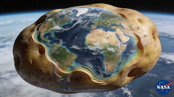
A new NASA image has sparked debate by showing Earth with a distorted shape. The model, based on gravity data, reveals subtle variations in sea level. Scientists use this tool to improve mapping and navigation.
A striking image released by NASA has triggered widespread discussion after depicting Earth in a form that defies the familiar globe. The visual, which quickly gained traction on social media, presents the planet with pronounced irregularities—prompting comparisons to a potato and fueling speculation about Earth's true shape. However, the reality behind the image is rooted in scientific modeling, not physical appearance.
The image represents the 'geoid,' a scientific construct that illustrates what the global sea level would look like if it were determined solely by gravity, without the influence of tides, winds, or currents. According to NASA, the apparent distortions are not arbitrary: they reflect genuine, though extremely subtle, variations in Earth's gravitational field. To make these differences visible, NASA amplified them by a factor of 10,000. In practice, the actual deviations in sea level are only a few dozen meters—virtually undetectable on a planetary scale.
Scientists rely on the geoid model to study Earth's structure with greater precision. By isolating the effects of gravity, the model helps researchers refine global maps, enhance navigation systems, and deepen understanding of the planet's physical properties. The geoid is not intended to suggest that Earth is physically misshapen, but rather to provide a tool for analyzing how gravity subtly alters the surface of the oceans.
The underlying cause of these variations lies in the uneven distribution of mass within Earth's interior. Gravity is not uniform across the globe; it is slightly stronger in some regions and weaker in others, depending on the composition and density of materials beneath the surface. The geoid model captures these minute differences, which have been mapped using over a billion data points collected by specialized satellites over a fifteen-year period. This extensive dataset allows scientists to produce highly accurate representations of Earth's gravitational field.
Understanding the geoid has practical implications beyond academic research. Accurate gravity models are essential for satellite navigation, geodesy, and even for monitoring changes in sea level that could impact coastal communities. The geoid also serves as a reference for measuring elevations and for calibrating instruments used in Earth observation. While the viral image may appear bizarre, it is a powerful reminder of the complexity underlying seemingly simple concepts like 'sea level.'
For context, the concept of the geoid is central to modern geophysics and cartography. Unlike the perfect sphere often depicted in textbooks, Earth's actual shape is an oblate spheroid, slightly flattened at the poles and bulging at the equator due to rotation. The geoid adds another layer of nuance, reflecting the planet's dynamic interior and the gravitational anomalies that result. As satellite technology advances, models like NASA's geoid will continue to play a crucial role in understanding Earth's changing environment and in supporting applications ranging from climate science to infrastructure planning.