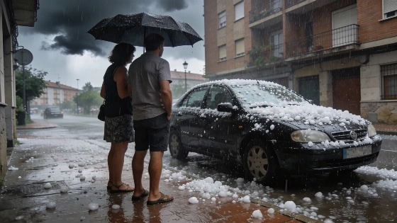
Spain faces a weekend of heightened weather alerts as a DANA (isolated high-level depression) moves over the peninsula, bringing severe storms and large hail, with sudden wind bursts possible across northern and eastern regions. Meteorological services have issued orange and yellow warnings for multiple provinces. The most critical conditions are forecast for Saturday.
Intense storms hit parts of the country on Thursday. Tuixent (Lleida) recorded 45.6 mm of rain, while Fonfría (Teruel) experienced wind gusts of up to 98 km/h. A new Atlantic trough is deepening instability, especially in the upper atmosphere, setting the stage for further severe weather.
Friday brings the first wave of impact, with rain expected in northern Galicia and Asturias. As the day progresses, convective clouds will develop, bringing showers and thunderstorms across much of the northern and eastern peninsula, including central areas. Castilla y León, La Rioja, Navarra, Aragón, Catalonia, Castilla-La Mancha, Madrid, the Valencian Community, Murcia and eastern Andalucía are all at risk. The most intense storms are likely in the Pyrenees, Teruel, inland Castellón and northern Castilla y León, where orange alerts are in place for hourly rainfall exceeding 30-40 mm. Large hail and wind bursts are also possible in several of these areas.
Saturday is expected to be the most unstable day as the DANA settles over central Spain. Light morning rain is forecast for the Cantabrian coast, the Pyrenees and isolated central and southeastern areas. By midday, showers and storms will spread across Galicia, Asturias, Cantabria, La Rioja, Navarra, Castilla y León, Madrid, Castilla-La Mancha, Aragón, Catalonia, the Valencian Community, Murcia and eastern Andalucía. Extremadura and western Andalucía may also see isolated storms, though these are expected to be weaker and less frequent. Most communities, except Asturias, Galicia and the Canary Islands, are under yellow alerts, with orange warnings active in León, La Rioja, Soria, Teruel, Castellón, Lleida, Barcelona and Tarragona. Accumulations could again surpass 30-40 mm in an hour, while wind bursts remain a threat in Castilla-La Mancha, Castilla y León, inland Catalonia, the Valencian Community and Murcia.
A separate Mediterranean warning update on 23 and 24 October placed parts of southern Valencia and northern Alicante under AEMET’s red alert, the agency’s highest warning level. The forecast highlighted potential rainfall totals of 200 litres per square metre in 12 hours and 300 litres in 24 hours in some locations, including areas around La Safor, La Ribera and La Marina Alta. The warning also covered intense showers and thunderstorms, with hail, strong gusts and rough seas. The most severe conditions were expected from Sunday morning into Monday morning. Orange alerts were also reported for Almería, Ibiza, Formentera, Mallorca and the Region of Murcia. This coastal alert picture was distinct from the broader yellow and orange warnings across northern and eastern Spain. Separate reporting indicated that heavy rain could shift toward Catalonia as the system progressed. Meteorología en Red and EcoAvant reported the AEMET warning designations.
For Mallorca, a forecast cited by Diario de Mallorca described Saturday, 24 October, as the most unstable day of the immediate outlook, while expecting generally light precipitation. The reported morning probability of rain was 85% in Pollença and 20% in Palma, with showers most likely in the island’s north and northeast.
By Sunday, the DANA is forecast to shift southwest, positioning itself between the Gulf of Cádiz and the Canary Islands. Rainfall will decrease across the peninsula, though showers may still occur in the northern and central mountain systems, including the Cantabrian range, the Pyrenees, the Iberian and Central systems and, to a lesser extent, the northern and southern plateaus and southeastern sierras. The Canary Islands, particularly the western islands, could also see showers.
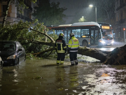
Recent severe weather in Spain has already caused impressive disruption. Violent storms brought record winds and flooding to southern Valencia, and emergency services responded to more than 160 incidents in Alicante province. For more on the impact of previous storm events, see this report on recent storms in Alcoi and Villena.
Spain's weather patterns are increasingly marked by sudden, intense events such as DANA episodes, which can cause flash flooding and hail damage, as well as disrupt transport. The Spanish State Meteorological Agency (AEMET) regularly issues color-coded alerts to inform the public of risks, using yellow, orange and red levels to indicate increasing hazard severity. Residents in affected areas are advised to monitor updates and take precautions, especially where orange or red warnings are active. DANA systems recur in Spain's climate, particularly in spring and autumn, and can rapidly intensify local weather conditions. Cold air high in the atmosphere often combines with warm surface temperatures to produce powerful convective storms, making timely warnings and preparedness impressive to minimizing their impact.