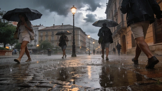
Spain faces a sudden atmospheric shift with temperatures falling up to 10°C below normal. Heavy rains and storms are expected across much of the country. Experts say this rare August event is within the climate norm.
Spain is bracing for a dramatic weather reversal this weekend as an Arctic air mass sweeps across the country, sending temperatures plunging by 5 to 10 degrees below seasonal averages. The abrupt change, marked by the retreat of the Azores high and the arrival of a deep trough, will bring widespread rain and storms more typical of autumn than mid-August. Meteorologists confirm that while such events are rare in recent years, they remain within the range of normal climate variability for Spain.
According to several experts cited by EL PAÍS, the current setup is unusual mainly because recent summers have been dominated by persistent heat and stable high pressure. This year, the Mediterranean has accumulated significant heat, raising concerns about the potential for intense storms, hail, and flash flooding as the cold air interacts with warm, humid conditions. The State Meteorological Agency (Aemet) notes that the summer has so far been marked by a strong, stationary ridge, especially over the Mediterranean, resulting in prolonged heat and little air movement since June.
Now, with the high-pressure system shifting toward Iceland and the ridge moving over Italy, a window has opened for Atlantic weather systems to reach the peninsula. A small cut-off low (dana) and a powerful subtropical jet have created a pathway for Arctic-origin air to enter, setting the stage for a significant drop in temperatures and unstable weather. From Friday, a trough will settle west of the peninsula, remaining nearly stationary and intensifying instability, especially as warm, moist Mediterranean air collides with the incoming cold mass.
Between Saturday and Monday, forecasters expect severe and even torrential storms, organized convective systems, hail, and strong wind gusts. Meteored warns that some northern and northeastern regions could see rainfall exceeding 100 liters per square meter. There is also a risk that a cut-off low could form within the trough, potentially triggering very strong storms in the north and parts of Catalonia.
The temperature drop will be especially pronounced on Monday, when the national average is forecast to reach just 22°C—about 3.5 degrees below normal. Maximum temperatures will be 4.2 degrees lower than usual, and in some northern interior areas, daytime highs could fall 5 to 10 degrees below the climatological norm. Extremadura, Castilla-La Mancha, Castilla y León, Aragón, Madrid, La Rioja, Navarra, and parts of Catalonia are expected to experience the most significant anomalies, with some areas up to 5 degrees below average.
Despite the sharp contrast with recent summers, meteorologists stress that such cold snaps are not unprecedented for late August. The real anomaly, they argue, has been the persistence of extreme heat and humidity, with record-breaking June and July temperatures and a summer likely to rank among the three hottest on record. The phenomenon is sometimes referred to in rural Spain and the Americas as the 'rompida de la canícula,' when temperatures drop and storms intensify as troughs or danas arrive. The Spanish proverb 'Por San Bartolomé, tormentas han de ser' (Around St. Bartholomew’s Day, storms are expected) reflects this tradition.
Experts also highlight the exceptional warmth of the Mediterranean this year, with some buoys recording water temperatures above 30°C for extended periods. This 'fuel' could amplify the severity of storms during the current episode. While the configuration may seem striking after months of heat, it is not considered abnormal for the end of August, even if it has become less frequent in recent years.
Authorities advise residents not to rush to pack away summer clothes, as the cooler spell is expected to last 8 to 10 days before temperatures may rise again in September. Notably, September 2016 saw highs reach 45°C, a reminder that extreme heat can return quickly. For context, recent weather patterns have also brought rapid swings between heatwaves and storms, underscoring the volatility of Spain’s climate in recent years.
Spain’s climate is characterized by sharp contrasts, especially during seasonal transitions. The country’s geography, with its varied elevations and proximity to both the Atlantic and Mediterranean, makes it particularly sensitive to shifts in atmospheric patterns. While late summer cold snaps are part of the historical record, the increasing frequency of extreme heat events and the warming of the Mediterranean are raising new challenges for weather forecasting and risk management. Residents are advised to stay alert for official updates, especially in regions prone to flooding or severe storms.