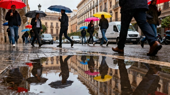
Barcelona sidesteps the worst of the region's heatwave as storms move in. Temperatures drop sharply from Wednesday, bringing unsettled weather and a break from the recent swelter.
Barcelona’s stretch of intense summer heat is about to end. While much of the surrounding region remains under a yellow alert for high temperatures, the city itself will avoid the worst, thanks to a shift in the weather that brings storms and a noticeable drop in temperatures starting midweek. After days of relentless heat, this change offers some relief, but also means residents and visitors will need to adjust to unsettled skies and rain.
Today, the heat lingers a little longer. Temperatures are expected to reach 33°C by late afternoon, with the heat index climbing to 36°C. The morning starts clear, but clouds will build by midday, and light rain is likely in the evening. Although the Agencia Estatal de Meteorología (AEMET) has issued a yellow alert for parts of the province, Barcelona’s city center is not included, sparing it from the most dangerous conditions. According to El País, citing Observatori Fabra, the city recently hit 35.5°C on September 5th—a new September record, beating the previous high of 34.1°C set just a day earlier, which had stood since 1914.
"Meteocat and AEMET forecasted a 75% chance of thunderstorms in Barcelona on Wednesday and up to 85% probability of rain on Thursday, highlighting the abrupt weather shift."
— Metropoli Abierta
Tomorrow brings a clear change. Wednesday will start with heavy clouds and a good chance of thunderstorms through the morning. By afternoon, the risk of storms drops, but the clouds remain. Temperatures will fall sharply, with highs around 29°C and lows near 20°C, making for a much cooler day. The southern breeze continues, but without the oppressive heat. As reported by ARA, this marks the end of an unusual heatwave across Catalonia, caused by a cold upper-level trough that is bringing storms and lower temperatures throughout the region.
Thursday’s forecast calls for less rain, but the unsettled pattern sticks around. The morning will be cloudy, clearing as the day goes on. Temperatures stay steady, ranging from 19°C to 28°C, with mild southern winds. Looking ahead to the weekend, Saturday may bring brief showers and cloudy spells, while Sunday should be mostly cloudy but dry, with highs near 29°C and lows around 21°C. Winds will shift slightly to the southeast, bringing gentle breezes across the city.
Nearby towns will also see changing skies and temperatures, with occasional light rain and sunny periods. The wider region is no stranger to sudden weather shifts, as shown by recent heavy rains in Catalonia that closed schools and disrupted daily life. While Barcelona avoids such extremes this week, the forecast is a reminder of how quickly summer weather can turn.
"Meteocat expanded official warnings for heavy rainfall in Catalonia, issuing red alerts for areas like Bages-Penedès, Alt Penedès, Garraf, Baix Llobregat, and Vallès Occidental, and orange alerts for the rest of Barcelona province and parts of Girona and Tarragona."
— ARA
For residents, the sudden switch from heat to cooler, stormier weather means changing routines and keeping an eye on the forecast. The city’s infrastructure, used to long dry spells, now has to handle bursts of rain and shifting temperatures. This kind of pattern isn’t unusual for Mediterranean summers, where hot spells can quickly give way to storms, but the speed of this week’s change is notable. Barcelona’s ability to move from heatwave to storm mode without major disruption shows both the city’s resilience and the unpredictability of the local climate. As the city moves through this unsettled stretch, one thing is clear: summer in Barcelona rarely follows a script.