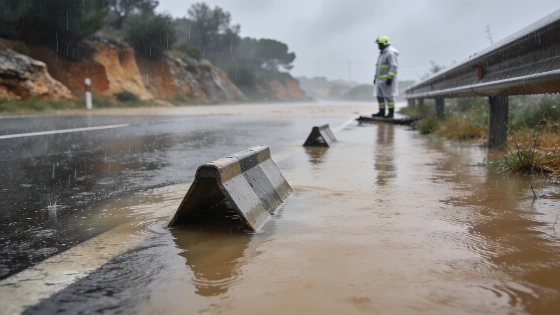
Tarragona could receive more than 250 litres per square metre. Heavy rain will spread across Spain on Friday, with emergency services urging extreme caution from early morning.
AEMET's red warning begins at 18:00 on Thursday across the coast and northern interior of Castellón, the coast of Valencia and the coast of Tarragona. It is expected to remain in place through Friday.
More than 250 litres of rain per square metre could fall in Tarragona within 12 hours on Friday. The province has already seen flooded roads as the storm system moved across Catalonia.
The heaviest burst could reach 90 litres per square metre in one hour. That speed and volume create a direct flood risk and make driving dangerous on affected roads. Emergency services have urged people in Tarragona, Castellón and Valencia to take extra care.
Protecció Civil sent Es-Alert flood warnings to several Tarragona comarcas, including Garraf, Alt and Baix Penedès, Alt Camp, Tarragonès and Baix Camp, after earlier alerts in Montsià, Baix Ebre and Ribera d’Ebre.
The warning reaches well beyond the eastern coast. It covers southern Alicante, the Region of Murcia and the area around the Almería and Jaén border. Castilla-La Mancha, the Community of Madrid, southern Castilla y León and parts of Aragón also face storm-related risks.
The rain will start early.
Thursday had already brought repeated alerts across Catalonia and the Valencian Community. The warnings reached red level in the afternoon after rain became much heavier. Water covered roads in Tarragona and disrupted traffic. Regional Catalan authorities confirmed local flooding and traffic problems as storms strengthened over the Mediterranean.
Meteocat identified Terres de l’Ebre, Camp de Tarragona, Penedès and Garraf as risk areas, with some downpours expected to exceed 40 litres per square metre in 30 minutes, accompanied by thunderstorms and locally hail.
Meteocat has identified Terres de l'Ebre, Camp de Tarragona, Penedès and Garraf as risk areas. Some downpours could exceed 40 litres per square metre in 30 minutes. Thunderstorms and local hail are also possible.
The storms are becoming more organised over the Mediterranean. Tarragona sits at the centre of the forecast, with Castellón and Valencia also facing further storm activity. Southern Alicante and Murcia remain on the risk map.
Flooding is the main concern. Catalan authorities link the red alert to both rainfall intensity and the total amount expected. Sudden floods, road closures and movement restrictions could begin during the first hours of the warning.
The wider map matters.
People in inland regions may face dangerous conditions even though the highest figures are forecast for Tarragona. The mix of coastal and inland alerts extends the risk far beyond the areas hit on Thursday.
No end to the storm is given in the available Friday forecast. Tarragona could receive more than 250 litres per square metre in 12 hours, with up to 90 litres possible in one hour. Those figures explain why the province has the highest warning level.
Regional authorities say the red alert reflects both the intensity of the rain and its expected accumulation. Roads may close quickly, and travel could become difficult.
Residents should take the warnings seriously from early morning. Avoid unnecessary travel near flooded roads. Friday will bring the most dangerous conditions in Tarragona, while other parts of Spain also face storm risks.