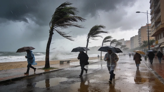
A powerful Atlantic storm is set to reach Spain, bringing heavy rain, strong winds and a marked drop in temperatures. The system, rare for August, will mainly affect the northwest and northeast from Monday.
Spain faces a rare summer weather event as an unusually intense Atlantic storm approaches from the northwest, set to disrupt conditions across much of the country from Monday. The Agencia Estatal de Meteorología (AEMET) warns that the system, currently intensifying over the North Atlantic near the Azores, will bring heavy rain, thunderstorms, strong winds and a significant fall in temperatures, especially in the northwest and northeast regions.
Forecasts indicate that the storm will reach its peak strength while still far from the Iberian Peninsula, but its effects will be felt as it moves closer to Portugal and western Spain. According to AEMET, the most noticeable changes will begin early in the week, with persistent rainfall expected in Galicia and other northwestern areas, while thunderstorms could develop in the northeast. Winds are forecast to reach moderate to strong levels, with locally intense gusts likely to worsen sea conditions along the Atlantic coast.
Meteorologists note that such powerful low-pressure systems are highly unusual in August, as they typically occur during colder months. Meteored highlights that the storm could reach exceptionally low pressure values for this time of year, potentially making it one of the most intense August storms recorded in the region. However, experts stress that while the system's oceanic intensity is remarkable, its direct impact on Spain will be less severe as it is expected to weaken before reaching the mainland.
The arrival of the storm will also usher in a mass of cooler air, leading to a sharp drop in temperatures across large parts of Spain. The start of the week will feel noticeably less hot, marking a stark contrast to the variable weather that has characterized August so far. The storm's influence may extend beyond its core, with Meteored suggesting that its position could channel humid easterly air into Catalonia and the Valencian Community, increasing the likelihood of rain bands moving in from the southeast.
Despite the anticipated cooling, the risk of wildfires remains high. AEMET cautions that fire danger will persist across a broad swath of northern Spain, reaching extreme levels in some areas where southerly winds may arrive dry and heated. This means that even as temperatures fall, vigilance against fire outbreaks is still necessary.
The storm's unusual strength has drawn the attention of the US National Hurricane Center (NHC), which is monitoring the system for any signs it might temporarily acquire tropical or subtropical characteristics as it crosses the Atlantic. The NHC currently estimates only a 20% chance of such a development, noting that the window for this transformation is brief and will close as the storm nears Portugal and northwest Spain, where atmospheric conditions become less favorable. Importantly, the NHC emphasizes that the system is not a hurricane and its origin is non-tropical, though it may briefly display some features typical of tropical systems while still over open water.
As Spain prepares for this abrupt weather shift, authorities and residents are advised to stay alert for updates and local advisories. The situation echoes previous rare summer storms that have affected the region, such as the event covered in recent reports on heavy August rains and weather alerts in northern Spain. While the current system is expected to weaken before landfall, its timing and intensity remain highly unusual for the season.
For context, August storms of this magnitude are rare in Spain, where summer weather is typically dominated by stable high pressure and heat. The Atlantic can occasionally produce powerful systems that reach the Iberian Peninsula, but these are more common from autumn to spring. The involvement of the NHC underscores the storm's exceptional nature, though the risk of it becoming a tropical cyclone remains low. Residents in affected areas should monitor official forecasts and be prepared for rapidly changing conditions, especially in regions prone to flooding or wildfire risk.