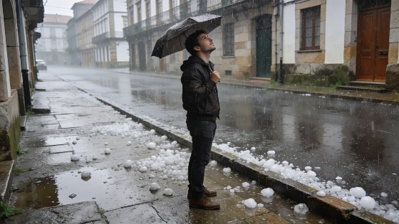
A new Atlantic front triggers violent storms and hail in northwest Spain. Strong winds and sudden temperature jumps mark a day of sharp contrasts across the country. Mediterranean regions remain stable but face heat.
Northwest Spain faces a new wave of severe weather as an Atlantic front sweeps in, bringing violent storms, hail, and sudden bursts of wind. The western part of Galicia is at the center of the disruption, with intense downpours and hail reported as unstable air masses move from west to east. By afternoon, the storm system is expected to intensify along the Cantabrian coast and reach the western Pyrenees and Cinco Villas in Aragón, prompting weather alerts for wind gusts exceeding 70 km/h in parts of the northern plateau and mountain areas.
While the northwest contends with turbulent skies, much of central and southern Spain, as well as the Balearic Islands, remain under the influence of high pressure from the Mediterranean. This brings a stark contrast: stable, mostly clear conditions dominate these regions, though suspended dust may cause light muddy rainfall in the eastern third and some islands. Temperatures in these areas are set to climb, with the Ebro Valley, Segura basin, and the Valencia pre-coastal zone expected to surpass 35°C. In contrast, coastal Mediterranean areas and the Gulf of Cádiz will see a moderate drop in temperatures.
Minimum temperatures are also shifting, rising along the Mediterranean but falling elsewhere. The Canary Islands experience a mild transition, with clear skies in the south, some cloud in the north, and moderate trade winds. The day’s weather map highlights two opposing dynamics: a surge in maximum temperatures in the eastern Cantabrian, Navarra, and the Ebro Valley—sometimes by more than six degrees compared to the previous day—while other regions brace for a noticeable cooling.
Weather authorities have issued warnings for strong winds and severe storms, especially in the northwest. Residents in affected areas are advised to remain alert for sudden changes in weather and possible disruptions. The situation echoes recent patterns, as a previous Atlantic storm system also brought heavy rains and temperature drops across Spain, underlining the volatility of late summer weather in the region.
Spain’s varied geography often leads to sharp contrasts in weather conditions. While the Atlantic fronts can bring rapid and intense changes to the north and northwest, the Mediterranean’s high-pressure systems typically stabilize the south and east. Such patterns are common in late August, when the clash between lingering summer heat and incoming Atlantic systems can produce both extreme heat and sudden storms. For residents and travelers, staying informed about local forecasts is essential, especially as weather alerts can change quickly. The Spanish Meteorological Agency (AEMET) regularly updates warnings and advisories, helping communities prepare for abrupt shifts in weather.