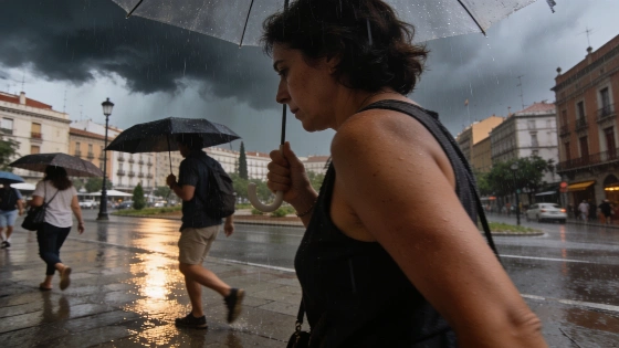
A storm over Portugal is driving intense rainfall and storms across much of Spain. The northeast and Balearic Islands face severe weather, while temperatures fall sharply in several regions.
Spain faces a turbulent start to the week as a storm system over Portugal pushes across the western peninsula, triggering widespread rainfall and a marked drop in temperatures. According to the Agencia Estatal de Meteorología (Aemet), Monday brings unstable weather to large parts of the country, with the most severe conditions expected in the northwest, northeast, and Balearic Islands.
Western regions will see persistent and locally intense rain as the storm’s fronts move eastward. The northeast and Balearic Islands are bracing for strong or even very strong thunderstorms, with the risk of damaging winds and large hail. In some areas, the formation of tornadoes cannot be ruled out. Only the southeast and parts of the central peninsula are likely to escape the worst, with clearer skies forecast there. Meanwhile, the Canary Islands will experience cloudy conditions in the north, with light rain possible in mountainous zones.
Maximum temperatures are set to fall across most of Spain, with the most pronounced drops—over six degrees—expected in the western half of the northern plateau and the Central System. Coastal areas, the Mediterranean pre-coastal regions, and the islands will see little change or a slight rise in temperatures. Despite the general cooling, some locations in the Ebro valley, Mallorca, and the Levante pre-coastal area may still exceed 35°C. Minimum temperatures will rise in the eastern Cantabrian region, parts of the southwest, and the Canary Islands, but remain stable elsewhere.
Winds will predominantly come from the southwest or south, generally moderate but with occasional strong gusts. Galicia, the plateaus, and mountain areas in the northern half could see gusts exceeding 70 km/h. In the Levante and Balearic Islands, winds will shift from southeast to southwest, while the Alborán coast expects moderate westerlies, with the possibility of very strong gusts. The Canary Islands will see northern winds turning northeast by the end of the day, maintaining moderate strength.
Recent weather patterns have brought similar instability to Spain, with previous storms in August already causing heavy rainfall and weather alerts in the north and east. The current system continues this trend, underlining the unusual nature of this summer’s weather.
Spain’s varied geography means the impact of such storms can differ sharply between regions. The northwest, exposed to Atlantic systems, often bears the brunt of incoming fronts, while the Mediterranean coast and islands can experience sudden, intense storms with hail and strong winds. The Aemet regularly issues warnings for these events, and residents are advised to stay updated on local forecasts, especially during periods of rapid weather change. The combination of heavy rain, wind, and hail can disrupt transport, damage crops, and pose risks to safety, making timely information crucial for both residents and visitors.