Tuesday morning in Spain began with alarming news for residents in seven autonomous communities. Authorities have issued storm warnings of varying levels: some areas are expecting snowfall, while others face strong winds and dangerous waves. The situation is especially tense in Castilla y León and Madrid, where heavy snowfall is possible until 2 p.m., particularly in the mountainous regions.
Later in the day, Andalucía and País Vasco will join the list of regions under adverse weather conditions, with strong waves and gusty winds forecast along the coast. In Galicia, an orange-level weather alert has been in effect since 8 a.m. due to a powerful sea storm. In Asturias, warnings will be issued in the afternoon, and in Cantabria, closer to evening. Meteorologists note that the weather may change rapidly and advise residents to remain especially vigilant.
Atlantic front
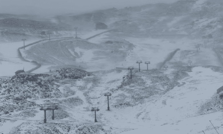
The worsening weather is due to another Atlantic front moving west to east across the entire Iberian Peninsula. Since morning, most of the country has been covered by thick clouds, with light rain in some areas. Precipitation will temporarily subside by midday, but another front is expected by evening, bringing a new wave of rain, especially to western and northern regions.
Galicia will once again be at the center of severe weather: heavy and prolonged rains are possible here, which could lead to local flooding. Strong downpours are also likely along the Cantabrian coast and in the western part of the country. In the central and northern mountains, snow will begin to fall at elevations of 1,000 to 1,200 meters, and in the southeastern regions—from 1,500 to 1,700 meters. In some areas, the snow cover may increase significantly, especially in the Sistema Central and in the northern Iberian mountains.
Weather in other regions
The Canary Islands (Islas Canarias) will be mostly cloudy today, with short, scattered showers possible, particularly in mountain areas. In the central part of the country, as well as on the northern and eastern plateaus, thick morning fog will appear in some places and may linger in the mountain regions and in Galicia until midday.
Temperatures across the country will be uneven. In the Valencian Community, Melilla, northern Meseta, and the Balearic Islands, daytime temperatures will rise slightly. In other regions, however, it will get cooler. Nighttime lows will remain almost unchanged, though light frost is possible in the northern and southeastern mountains, as well as on the plateau. Frost in the Pyrenees will be more pronounced.
Wind and waves
Wind will be one of the main risk factors today. Strong gusts of west and southwest winds are expected on the coast, in the northern and southeastern areas, as well as on the plateau. Particularly powerful squalls are possible in Galicia, along the Cantabrian coast, and in the Mar de Alborán area. The Canaries will experience prevailing trade winds, which may locally reach storm strength.
Sailors and coastal residents have been warned about high waves and the dangers of going out to sea. In some areas, wave heights may exceed normal levels, posing a threat to shipping and infrastructure.