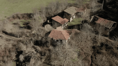
When people think of Andalusia, they usually imagine the endless beaches of the Costa del Sol. However, the region’s true treasures are hidden from most eyes, far from the hustle of the coast, deep in the heart of the mountains. It is there, in the municipality of Villanueva del Rosario, that one of the most impressive hiking trails unfolds, offering entirely new experiences even to seasoned travelers.
This is the “Pilas del Señorito” trail, a circular route of almost seven kilometers winding along the slopes of the Sierra de Camarolos. The walk is not for lazy strolls, but neither does it require mountaineering skills. The elevation gain is about 450 meters, with the highest point reaching 1,403 meters above sea level, making it accessible to those in good physical condition. On average, the trail takes about three hours to complete—three hours of total immersion in wild nature. Hikers are rewarded with breathtaking views of Pico Chamizo, one of the dominant peaks in the comarca, as well as such iconic spots as Tres Mojones, El Pelao, and Los Jardines, each adding its own unique flair to the journey.
The adventure begins near the Fuente de la Sarsa spring, where a dirt road lined with pine trees leads travelers upwards. Gradually, you enter the Hondenero area, where a natural spring emerges from the ground, forming a small pond—an oasis of coolness and life. The route then passes through the Tres Mojones gorge, the geographic point where the borders of three municipalities—Villanueva del Rosario, Colmenar, and Alfarnate—meet. As you ascend, the landscape changes dramatically. The pine groves give way to striking karst formations. Sections covered with lapies—sharp limestone ridges—require attention and caution from hikers but offer ample rewards. From this height, you can take in the majestic terrain of the province and even spot traces of the ancient Riogordo landslide.
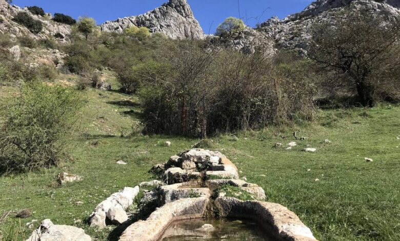
The final stretch of the route descends through the Canuto-Pisebre canyon and the Cañada del Sao ravine. Here, travelers once again find themselves in the shade of a pine forest, planted to help restore the ecosystem. It is along this section that you’ll find the site lending its name to the entire trail – “Pilás del Señorito.” These are large stone troughs, which many years ago were used to collect water for livestock. These simple constructions stand as silent witnesses to the history of the area, a reminder of times when only shepherds and their flocks roamed these slopes. Returning to the starting point closes the loop, leaving behind a kaleidoscope of impressions. For a safe and comfortable hike, it’s best to avoid days that are rainy or foggy, as the rocky surface becomes slippery. Sturdy footwear, warm clothing, and a GPS device with the route loaded will be your best companions on this unforgettable journey along one of the region’s most comprehensive and interesting trails.