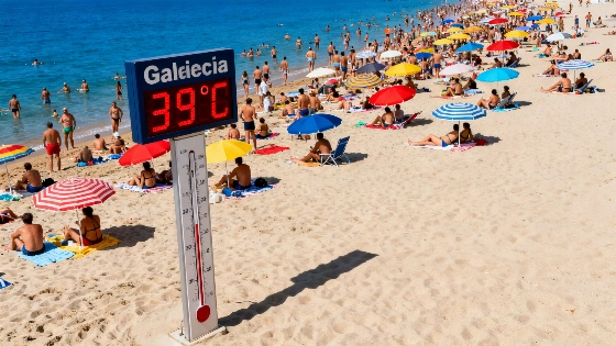
Spain's heatwave is winding down, with Aemet forecasting a shift to more typical summer temperatures. A trough will bring storms and rain to the north, affecting daily life and travel in several regions.
The Spanish Meteorological Agency (Aemet) has officially declared the end of the intense heatwave that gripped the Iberian Peninsula this week. While high temperatures will persist in many areas, the extreme values seen in recent days are set to ease, with conditions returning to seasonal norms. The most significant change, however, is the arrival of a trough that will bring instability and a marked increase in storms and rainfall across much of northern Spain.
According to ElTiempo.com, Sunday will begin with low clouds and mist in regions such as Galicia, the Cantabrian coast, the Alboran Sea, and the Balearic Islands. These clouds are expected to clear as the day progresses. By afternoon, convective clouds will develop over mountain areas in the eastern third and far north, leading to isolated showers in the Cantabrian Mountains, the Pyrenees, and the Iberian System. A weather front will approach Galicia, bringing the first significant rainfall, while low clouds could also produce showers in the mountainous areas of the Canary Islands, accompanied by haze in the southeast and on the islands themselves.
Temperature trends will vary across the country. Maximum temperatures are forecast to rise in the Cantabrian region, northern Galicia, the Mediterranean arc, and locally in the Canary Islands, while a slight drop is expected in the Atlantic regions. Despite the overall moderation, highs above 35°C will still be recorded in the southern half of the peninsula, the northeast, Mallorca's interior, and the Canary Islands. The Guadalquivir valley may even see temperatures reach 40°C, with tropical nights likely in the Canary Islands, much of southern Spain, the Ebro valley, and the Mediterranean coast.
From Monday onwards, the passage of the trough over northern Spain will trigger a new phase of instability. Intense thunderstorms are expected in Galicia, Asturias, Cantabria, and the northwest of Castilla y León, gradually moving towards Aragón by late evening. On Tuesday, the most severe storms will concentrate in the Pyrenees, the Cantabrian Mountains, and the southern Iberian System, with the possibility of further isolated showers in other central and eastern mountain areas.
This shift in weather comes after a period of persistent heat, echoing patterns seen in previous years. For context, a recent analysis highlighted by RUSSPAIN noted that Spain often experiences brief cool spells before heat returns, with rainfall typically limited to select regions. The current forecast suggests that, while the heatwave is ending, the north will face increased rainfall and storms, potentially impacting travel, agriculture, and daily routines in affected areas.
Spain's climate is characterized by sharp contrasts between regions, especially in summer. The north, influenced by Atlantic systems, frequently sees more precipitation and cooler temperatures compared to the arid south and Mediterranean coast. The arrival of a trough often signals a temporary break from heat, but also brings the risk of localized flooding and disruptions. Residents and travelers in northern Spain should remain alert for sudden weather changes, particularly in mountainous and coastal zones. The Aemet continues to monitor developments and will issue updates as conditions evolve.