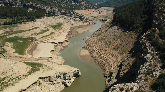
New geological research confirms a prehistoric flood in Segovia raised the Eresma River by 11 meters. The event, dated to 49,000 years ago, left sediment traces still visible today. Experts highlight its relevance for modern infrastructure planning.
Geological studies have confirmed that a catastrophic flood struck the Eresma River valley near Segovia around 49,000 years ago, dramatically raising the river’s level by 11 meters. This event, comparable in scale to recent disasters in Asia, left behind thick layers of sediment that are still visible in the region’s archaeological sites. The findings, led by Andrés Díez Herrero from the Instituto Geológico y Minero de España (IGME, CSIC), underline that such extreme natural events are not unique to distant regions but have also shaped the Iberian Peninsula’s landscape.
Researchers identified clear evidence of this ancient flood in the sediment layers beneath Neanderthal occupation sites at Abrigos del Molino and San Lázaro, just outside Segovia. These deposits, consisting of sands and silts with minerals from the Sierra de Guadarrama, point to a period when melting glaciers caused sudden lake bursts. The resulting torrents swept mud, stones, and debris through the Eresma valley, inundating caves and shelters that would later be inhabited by early humans.
Advanced dating techniques, including luminescence analysis, place the event at approximately 49,000 years ago. Computer models suggest the flood’s peak flow was four times higher than the largest recorded in January 1956, and even surpassed the historic flood of August 1540, which caused significant casualties in Segovia’s San Lorenzo and San Marcos districts. The scale of the prehistoric flood highlights the potential for extreme hydrological events in the region’s history.
In 2022, the San Lázaro cave gained international attention when the world’s oldest Neanderthal fingerprint was discovered there, further emphasizing the site’s significance. The geological record shows that as glaciers melted in the Sierra de Guadarrama, small lakes formed and occasionally burst, triggering powerful floods that reshaped the valleys. These events not only altered the landscape but also influenced the settlement patterns of early human populations in central Spain.
According to Díez Herrero, the study of paleofloods has practical implications for modern infrastructure. On behalf of the Dirección General del Agua (MITERD), researchers have compiled a database of 299 paleoflood records across Spain, now accessible online. This information is valuable for water authorities and consulting firms, especially when planning new dams or flood defenses. In the United States, prehistoric floods are routinely considered in dam design, and Spanish regulations now require accounting for return periods of up to 10,000 years, depending on the type of structure.
The importance of understanding extreme weather events is underscored by recent disasters worldwide. For example, severe storms and flooding have also affected regions like Catalonia and the Balearic Islands, as detailed in reports on recent hailstorms and meteotsunamis. These incidents highlight the ongoing need for robust risk assessment and adaptation strategies in the face of natural hazards.
Spain’s geological history demonstrates that extreme floods are not just a modern concern. The evidence from Segovia’s river valleys serves as a reminder that ancient events can inform present-day decisions, helping authorities and engineers better prepare for future risks. As climate patterns shift and the frequency of severe weather increases, integrating paleoflood data into infrastructure planning becomes ever more critical for safeguarding communities and assets.