
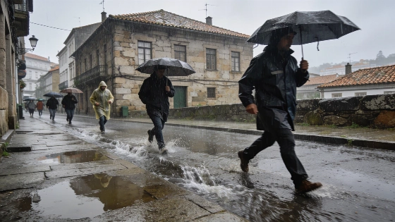
Spain faces a dramatic weather reversal as an Atlantic front brings widespread rain and a sudden plunge in temperatures. With red alerts in Catalonia and orange warnings in Galicia, the country braces for a distinctly autumnal start to October after a scorching summer.
Spain’s weather flipped fast this week. A strong Atlantic front swept in, dropping temperatures by up to 10 degrees in just a few days. Summer’s heat is gone. Now, rain and cold air cover much of the country. The State Meteorological Agency (AEMET) put Catalonia on red alert and issued orange warnings for Galicia. September ends with a real taste of autumn. AEMET, EFE, and RTVE all reported the highest risk in northern Tarragona, where forecasters warned of extreme rainfall. Galicia also faces heavy rain and coastal storms.
Morning lows now hit 9 to 13°C in the north. In the south, it’s about 15°C. That’s a big change from the heat that lasted through September. Even the warmest spots struggle to reach 29°C. The forecast shows no break from the damp, chilly air. AEMET warned that Catalonia could see up to 180 liters per square meter in just 12 hours. Some of that rain might fall in only 3 to 6 hours. Local flooding is a real risk.
Elsewhere in Catalonia, yellow and orange alerts were issued, with forecasts of up to 60 l/m² per hour and more than 150 l/m² in 3–6 hours, alongside warnings for hail, wind gusts of 70–90 km/h, and even possible waterspouts along the coast.
AEMET’s latest forecast says the Atlantic front will stick around until at least October 1. Rain will hit most regions. The heaviest downpours will move from the Cantabrian coast toward the east. Flooding risk is low for now, but AEMET may issue more warnings as the week goes on. Most areas will see clouds and scattered showers. The rain will be heaviest in the afternoon. In Galicia, AEMET expects up to 80 liters per square meter in 12 hours for the west and southwest of La Coruña. Coastal conditions will be rough, with strong southerly winds.
Anyone hoping for a last blast of summer will be disappointed. This week brings humidity, rain, and a steady autumn chill. Only the Canary Islands escape the worst. Storm chances there are low, though some haze may linger. Everywhere else, the models show a wet, cool pattern through the weekend. Rain is likely almost everywhere. AEMET’s weekly outlook confirms this isn’t just a local blip. Atlantic cyclonic fronts are driving the change, especially in the west and along the Mediterranean.
On September 28, AEMET had already warned of a significant weather change, with alerts for rain and storms issued not only for Catalonia and Galicia but also for Andalusia, Aragon, Cantabria, Castile and León, Castile-La Mancha, Extremadura, Navarre, and the Basque Country. This broad warning reflected the widespread impact of the Atlantic front across multiple autonomous communities.
Old-school forecasting methods like the Cabañuelas also point to a rainy October. The month will start quietly. The west may see slightly warmer weather, and Saharan dust could reach the Canaries. But by October 9, storms are expected to sweep in from the west and south. The Mediterranean coast will get hit soon after. The Levante region could see unsettled weather at the start of the Puente del Pilar holiday. The north will turn cooler, with light rain.
Jorge Rey, a young forecaster known for using Cabañuelas, expects the unsettled pattern to last through mid-October. Around October 12, warm African air could push up temperatures in the east. That won’t last. By October 17, clouds and light rain should return to the north. Conditions may improve after that. Any late warmth will be brief and much weaker than September’s highs.
Late October could bring another change. A strong anticyclone is forecast to break down around the 23rd or 24th. That would let a new front bring storms and rain to the north and center. The last days of the month might see better weather. Still, the Cantabrian coast could get more damp spells as cool, moist air moves in.
Earlier warnings about heavy rain and storms in Catalonia and other regions have now played out, as reported by Spanish media. The current forecast shows Spain is moving into a real autumn. Summer extremes are fading. The country is settling into a more typical October pattern.
AEMET has not yet released detailed guidance for the rest of October. The agency does not expect the wild swings seen in previous months. Instead, Spain is on track for a steady move toward winter. November will likely bring more cold and longer rain spells. For now, the message is clear. The season has changed. Spain must get used to wetter, cooler days. This isn’t just about the weather. After a summer that dragged on, the country is finally catching up with the calendar.