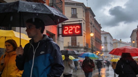
Seville faces a week of changing skies and stubborn heat. Temperatures will hit 33°C, with the first rain expected by Saturday. The forecast hints at real changes for locals and nearby towns.
Seville’s early summer routine is about to break. Clouds are moving in. The city will see a jump in heat and the first signs of rain this week. Tuesday starts calm, with only a few clouds. By midday, high clouds will cover the sky. Temperatures will reach 32°C, according to the Agencia Estatal de Meteorología (AEMET). AEMET had already flagged a sharp temperature rise for late September. Official bulletins put highs at 38–39°C in western and central Andalusia, including Seville.
Daytime highs barely change from Monday. But the early morning brings a chill. Lows will drop to 18°C around 8:00. The real feel will peak near 31°C and dip to about 17°C. Winds stay light, drifting from the south. There’s little relief. Independent summaries of AEMET forecasts showed Seville heading for 37°C, then 38°C, and in some spots up to 39°C between September 23 and 26. Rain is unlikely before the weekend.
Regional press confirms that the end of September in Andalusia is marked by an unusually hot period for the start of autumn, followed by a transition to cloudier and wetter conditions.
Wednesday brings more of the same. High clouds will linger. The top temperature matches Tuesday. The minimum creeps up, with a thermal sensation of 19°C at dawn. Thursday stays dry. The sky will shift again—starting with scattered clouds, thickening by midday. Temperatures will run from 18°C to 33°C. Summer holds on. Regional outlets and AEMET confirm the pattern: intense heat, then a turn toward instability and the first rain showers as the weekend nears.
The real change hits at the weekend. Saturday brings cloud intervals and the first rain showers of the week. Highs stay above 30°C. Lows hit 18°C. Sunday keeps the clouds and brings light rain. Temperatures settle at 31°C for the high and 19°C for the low. Winds on Saturday will be light from the southeast. Sunday’s air stands still. Official AEMET updates echo this pattern. They point to a clear drop in temperatures and local showers across much of Andalusia by the weekend.
Seville is not alone. Jerez de la Frontera starts the day under high clouds. By afternoon, skies turn variable. Temperatures swing between 17°C and 32°C. Benalmádena will see patchy clouds until midday, then clearer skies, with milder readings from 18°C to 27°C. Other cities—Ceuta, Jaén, Granada, Motril, Cáceres, Ciudad Real, Barcelona, Gandia, Figueres, Oviedo, Santiago de Compostela, Garrucha, Las Rozas de Madrid, and Telde—are also set for changing skies. Details remain provisional. AEMET will update forecasts as needed. Reports confirm this weather shift is hitting not just Seville but also nearby cities across Andalusia. High temperatures are giving way to more clouds in places like Jerez, Benalmádena, Jaén, and Granada.
Official AEMET maritime forecasts for the Andalusian coast indicate that no storm warnings are currently in effect for the region’s western and eastern seaboards, nor for Ceuta.
Spain’s weather keeps surprising. Recent extremes in the north, as reported by regional media, show how volatile the season has become. For Seville and its neighbors, the next few days will test how people handle heat and sudden changes. The region stands between summer’s grip and the first hints of relief. The forecast could still change. For now, routine is out. Adaptation is in.