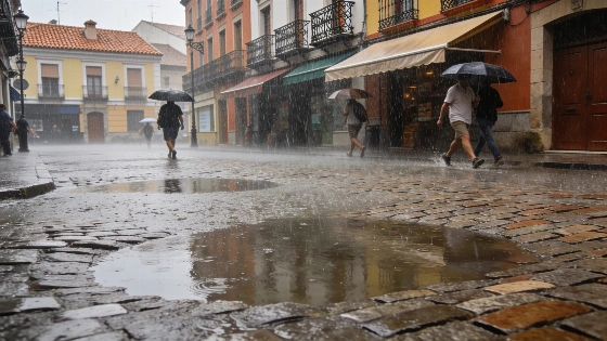
Spain faces a sharp weather shift as storms and heavy rain sweep in. Orange alerts are active for intense downpours and hail. Temperatures drop by up to 10°C in many areas.
Spain is experiencing a rapid end to the recent heatwave as a cold front brings storms, heavy rainfall, and a marked drop in temperatures. On Thursday, the first signs of this change appeared in the northwest, with unstable Atlantic air pushing across the peninsula. Orange weather alerts have been issued for parts of the north and east, where rainfall could reach 40 litres per hour and hail is expected.
According to ElTiempo.es, the unstable conditions are linked to a trough and a cold low-pressure system moving from the northwest toward the Mediterranean. The most severe storms are forecast for Thursday, especially in northern and eastern regions, but the risk will persist in some areas through the weekend. By Friday, the threat of intense storms will be less widespread, though localised heavy showers may still affect the Catalan coast, the Balearic Islands, and parts of the eastern Cantabrian coast.
Saturday is expected to bring isolated thunderstorms to the northeastern coast, with the possibility of scattered showers in Aragón and Catalonia. Some northern inland areas may also see brief rainfall. On Sunday, attention shifts to Galicia, where a compact cold low is set to increase cloud cover, rain, wind, and waves along the western coast. Meanwhile, the Canary Islands will remain under the influence of steady trade winds, with persistent cloud cover in the north of the higher islands.
The arrival of colder air has already caused a significant temperature drop, particularly in eastern Spain, where highs had recently exceeded 40°C. On Thursday, temperatures fell sharply in most regions except the Balearic Islands and the Canaries, where slight increases were still recorded. The cooling trend will continue on Friday in the northeast and Balearic Islands, driven by both the influx of cold air and increased cloudiness from storms. Saturday may see a slight recovery in maximum temperatures in the northwest, but further drops are possible in the Mediterranean interior. Sunday is expected to bring little change, though some southern and eastern areas could see a minor rebound in daytime highs.
Nighttime temperatures are also becoming more comfortable, with fewer tropical nights above 20°C, except along the Mediterranean coast, where warm sea temperatures continue to moderate nocturnal cooling. The overall pattern marks a clear break from the intense heat of previous days, as unstable Atlantic systems dominate the weather. This shift is not unprecedented for August, as similar abrupt changes have occurred in recent years. For context, a comparable episode of sudden cooling and heavy rain was reported in August 2024, when Spain saw temperatures plunge and widespread storms disrupt summer routines.
Spain's climate in late August is often marked by rapid transitions, with Atlantic troughs occasionally bringing relief from prolonged heat. Such episodes can cause localised flooding, travel disruptions, and agricultural impacts, especially when intense rainfall coincides with parched ground. Residents in affected regions are advised to monitor local forecasts and heed official warnings as the unsettled weather continues through the weekend.