Spain faces a sharp weather shift as storms and cooler air sweep across the country. Authorities warn of strong winds and possible flooding in several regions. The change disrupts recent summer stability.
Spain is bracing for a dramatic weather reversal this weekend, as a cold polar air mass and a fast-moving trough bring storms, heavy rain and a marked drop in temperatures to much of the country. The State Meteorological Agency (Aemet) reports that the shift, which began Thursday, will intensify through Sunday, with the northeast and Balearic Islands facing the highest risk of severe weather. The sudden change follows a period of stable, hot conditions, and is expected to push temperatures below seasonal norms in many areas.
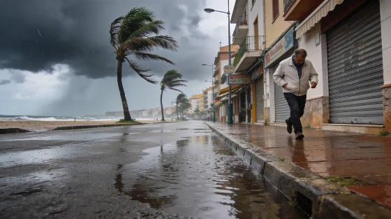
According to Aemet, the most immediate concern is for the Balearic Islands, where very strong, potentially hurricane-force gusts are possible, especially in Mallorca and Menorca during the early hours of Friday. Persistent rainfall is forecast for the Cantabrian coast, though intensity should ease as the day progresses. In the northeast, including southern Catalonia, storms may become locally intense and long-lasting, particularly along the coast later in the day. The risk of flash flooding is heightened in valleys and dry riverbeds, where sudden downpours could overwhelm drainage systems.
Looking ahead to Saturday, instability is set to persist in the northeastern third of the peninsula. Showers and storms could again be strong in southern Catalonia, eastern Aragon, northern Valencia and the central Pyrenees, especially overnight. Maximum temperatures will rise in most regions except for the Levante, Balearic Islands, Catalonia and the Canary Islands, where a further drop is expected. Minimum temperatures will climb slightly in central Spain but fall elsewhere and in both archipelagos. Winds will generally be light and southerly on the mainland, with moderate easterlies in the Cantabrian region and Galicia, and trade winds shifting northward in the Canaries during the afternoon.
On Sunday, the unsettled pattern continues, with further strong storms and showers likely in the northeast and Valencia. The risk of heavy rainfall may persist into Monday, though the exact location and intensity remain uncertain. Maximum temperatures are forecast to rise in the Cantabrian region, northern plateau, northeast and Balearic Islands, but fall in the southwest and Galicia. Minimums will increase in the north and decrease in the south and Balearics. Winds will mostly be light to moderate from the south, with stronger easterlies possible in the eastern third, Balearics, Ebro valley and Cantabrian coast. The Canaries will see light northerly winds. Notably, strong gusts cannot be ruled out in the Cantabrian area.
This abrupt weather shift is not unprecedented for August in Spain. As highlighted in recent coverage of similar cold air outbreaks, such events can bring rapid cooling and intense rainfall, disrupting summer routines and posing challenges for local authorities. The current forecast underscores the importance of monitoring official updates, especially for those in regions prone to flooding or strong winds.
Spain's varied geography means weather impacts can differ sharply between regions. The northeast, including Catalonia and the Pyrenees, often sees the most dramatic effects when polar air interacts with humid Mediterranean flows. The Balearic Islands are particularly exposed to sudden wind shifts and heavy rain due to their location. In recent years, local authorities have improved early warning systems and emergency response protocols, but residents are still advised to remain vigilant during periods of rapid weather change. For the latest updates and detailed forecasts, RTVE.es provides ongoing coverage and alerts.