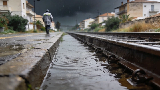
Tarragona and Castellón remain under red alert as Spain endures a second day of severe storms. Meteorologists warn of rainfall exceeding 300 liters in under 12 hours, with the Mediterranean coast hit hardest and alerts stretching across ten regions.
Emergency systems in Spain are stretched thin. Tarragona and Castellón are still under red alert. The Mediterranean coast is taking the hit for a second day. Some areas have already seen more than 130 liters of rain per square meter. The threat isn't over. Up to 300 liters could fall in less than 12 hours.
The State Meteorological Agency, Aemet, has widened its warnings. Ten autonomous communities are now on alert. The worst rain is hitting the central-northern coast of the Valencian Community and the southern part of Catalonia. Rainfall here has reached levels rarely seen outside the hottest months. San Andrés y Sauces (La Palma) logged 130 liters by late evening. Vandellòs (Tarragona) saw 84 liters. Polinyà de Xúquer (Valencia) recorded 72. Aemet officials said red alerts in Castellón, Valencia, and Tarragona were triggered by forecasts of up to 90 liters per square meter in just one hour and up to 250 liters in 12 hours. Spanish authorities called it "peligro extraordinario."
Authorities in the Valencian Community activated the ES-Alert system, sending emergency messages to residents in Castellón and Valencia due to the risk of flash floods and sudden river overflows.
Friday's alert map is a patchwork. Red, orange, and yellow warnings cover much of the country. Red alerts for rain stay in place through midday for the southern coast of Tarragona and all of Castellón. Orange alerts for rain and storms stretch across Catalonia, the Valencian Community, Andalusia, the Balearic Islands, and Murcia. Aragón, Castilla-La Mancha, Castilla y León, Madrid, and Extremadura face yellow and orange warnings. Local meteorologists in Catalonia raised the alert in several comarcas of Tarragona. The risk is highest in Tarragona and the Ebro area. Rainfall could top 40 liters per square meter in just 30 minutes.
One thing is making this storm worse. The Mediterranean is much warmer than usual. Sea surface temperatures in the western basin are above 26°C. That's up to 4°C higher than normal for early June. This extra heat is feeding the storm. More moisture means heavier rain and a longer threat. EFE reported that Castellón had already seen more than 100 liters per square meter before the main storm even hit. This is not a normal event.
What comes next? Aemet spokesperson Rubén del Campo says more rain is on the way for the Mediterranean and Balearic areas this weekend. But outside these zones, the rain should ease. Saturday's forecast keeps nine communities under alert. The worst red warnings will fade. Orange and yellow will take their place as the system weakens.
Official agencies warned that the episode would last at least until Saturday, with very intense and persistent rainfall expected along the Mediterranean coast and a heightened risk of flooding and river overflows. In some areas, total rainfall could exceed 300 liters per square meter in 12 hours, significantly increasing the danger of flash floods in coastal and low-lying zones.
By Sunday, a new weather system—a dana—will form. Its impact is still unclear. Del Campo says it depends on where the dana settles and how much moisture it draws in. The forecast puts the dana west of the peninsula. Instability and scattered showers will linger across much of Spain. The worst of the rain should be over. The Mediterranean coast will slowly calm down. Central and eastern inland regions could still see storms through Wednesday.
Spain's emergency response is under pressure. It's not just the amount of rain. It's how fast things change. Alerts have escalated quickly. The storm's path keeps shifting. Authorities have had to react on the fly. As reported earlier, Spain's crisis management is being tested—whether the threat comes from the sky or from unrest on the ground.
This storm shows how unpredictable Spain's climate can be as summer nears. Sea temperatures are far above normal. Weather patterns are more erratic. Sudden, high-impact storms are now a real risk. This week proves it. Adaptation and readiness are essential for Mediterranean regions. For now, people stay alert. The next wave could come soon.