Spain’s spell of calm weather is coming to an end as Cyclone “Claudia” approaches, bringing not just heavy rainfall but also an unexpected rise in temperatures. By Tuesday morning, residents in the northern regions were already noticing the change: skies clouded over, winds picked up, and the air began to warm.
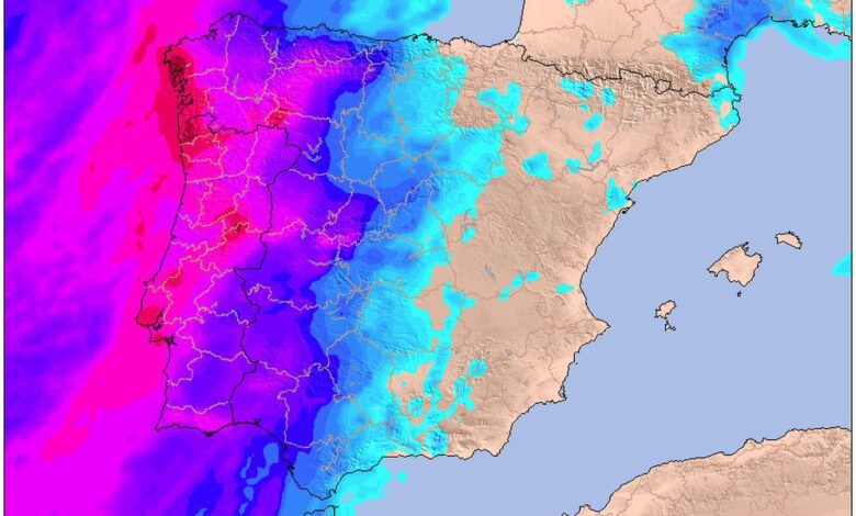
Galicia and the Cantabrian coast were the first to feel the impact. Here, southern wind gusts are reaching up to 70 km/h, and in western Galicia—especially around A Coruña—downpours have lasted for hours. Asturias, Cantabria, and Navarra are under a yellow weather alert due to strong winds, while Galicia faces an orange alert for heavy waves and significant rainfall.
The weather front is moving rapidly eastward, affecting more regions. Clouds and rain are covering western areas from the northwest of Castilla y León to Extremadura. In other regions, high clouds fill the sky, and on the Canary Islands, the first rain is expected as soon as Wednesday. There, forecasters predict heavy showers and thunderstorms, especially on the western islands, where a significant amount of rain could fall in a short period.
Despite rain and wind, air temperatures continue to rise. Southern air masses are preventing nighttime frosts, and thermometers are showing readings 5–10 degrees above the usual November levels. In some parts of Cantabria and along the Andalusian Mediterranean coast, nighttime temperatures aren’t dropping below +18°C, which is highly unusual for mid-November.
Warmth and downpours: regions facing abnormal weather
Wednesday will bring little change: rain will persist in Galicia, western Asturias, and Castile and León. Brief showers are possible in Extremadura and Huelva. Meanwhile, in some cities such as Cádiz, Murcia, and Ciudad Real, daytime temperatures will exceed +20°C, and in Melilla could reach +32°C. These figures are much more typical for late September than for November.
Weather anomalies will persist through Thursday, as temperatures keep climbing. However, by Friday, a sharp change is expected: a cooler air mass will move in, and the heat will give way to autumn chill. Temperatures will drop almost everywhere, though the north and Mediterranean coastal areas will retain relatively mild weather.
Rainy weekend ahead: what to expect next
As the weekend approaches, rain will intensify in the central and western regions. On Saturday and Sunday, precipitation will become more prolonged and cover most of the northern and central provinces. On the Canary Islands, after heavy rainfall earlier in the week, the weather will stabilize and the likelihood of new showers will decrease.
Thus, Spain is facing a series of weather contrasts: from abnormal warmth to heavy rains and a sharp drop in temperatures. Residents of the northern and western regions should be prepared for changes and closely follow the forecasts.