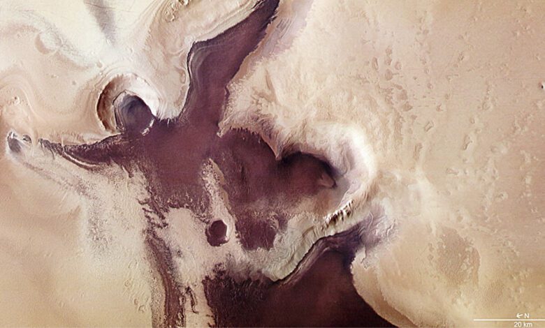
South Polar Cap: Mysteries of Martian Ice
The southern region of Mars has long drawn researchers’ attention thanks to its unique ice formations. Here at the pole, layers of water and carbon dioxide ice alternate with dust, creating a complex structure shaped by centuries-old climate changes. The surface layer consists of frozen carbon dioxide, which evaporates and recondenses each year, while the deeper layers remain almost untouched. Experts estimate that the polar ice cap is up to two kilometers thick and may be tens of millions of years old.
It was once believed that liquid water could be hidden beneath these massive layers. This conclusion was based on data analyzed from radars onboard the Mars Express and Mars Reconnaissance Orbiter missions. These instruments allow scientists to “see” beneath the surface by sending out radio waves and detecting the reflections from various layers.
Radar Signals and a Reassessment of the Water Hypothesis
In 2018, scientists detected unusually bright signals coming from beneath the ice cap. These reflections were interpreted as possible signs of brines—liquid salty lakes that could remain fluid even in extremely low temperatures. If confirmed, this hypothesis would make Mars’ south pole one of the prime sites in the search for traces of life beyond Earth.
However, fresh findings published in the scientific journal Geophysical Research Letters have led to a reassessment of previous conclusions. A team of researchers led by Gareth A. Morgan from the US Planetary Science Institute conducted a new analysis using the SHARAD radar. By changing the antenna’s angle of observation, they were able to obtain more accurate data on the structure of the glacier base.
What lies beneath the sedimentary rocks and the smooth crater floor
SHARAD also detected reflections from deep layers, but their intensity was a thousand times weaker than the signal previously recorded with MARSIS. Such a result is inconsistent with the presence of liquid water, since in that case the reflection would be much stronger. Computer modeling confirmed that the signal properties correspond to dry sedimentary rocks with low dielectric permittivity—a characteristic typical of frozen dust and sediment layers.
The scientists considered various scenarios, including the impact of dust, temperature fluctuations, the presence of salts, and even potentially elevated rock conductivity. However, none of these factors explained the difference in signal strength between the two radars. The researchers concluded that the reflection is linked to the landscape’s features: the smooth base of the glacier is likely the floor of an ancient crater covered by a thin layer of sediment or volcanic rock. It is this smoothness that could have created the illusion of a subglacial lake.
The question of water remains unresolved
Despite the new data, the possibility of liquid water beneath the ice cap cannot yet be completely ruled out. Scientists note that certain geophysical conditions could still allow water to remain liquid even in such a harsh environment. Only future missions equipped with drilling systems capable of penetrating kilometers-thick ice sheets and directly investigating their structure may provide definitive answers.
A new interpretation of the reflected signals is changing the strategy for searching for life on Mars. Experts are now shifting focus to studying the region’s geological features and searching for other signs that might indicate the presence of water, either in the past or in the present.
In case you didn’t know: Mars Express and Mars Reconnaissance Orbiter
Mars Express is a European spacecraft launched by the European Space Agency (ESA) in 2003. Its main mission is to study the atmosphere, surface, and subsurface layers of Mars. On board, Mars Express carries the MARSIS radar, which for the first time allowed scientists to obtain data on the structure of the polar ice caps and to search for possible bodies of water beneath the planet’s surface. Thanks to this instrument, the first hypotheses about the presence of liquid water beneath the southern polar cap were made.
The Mars Reconnaissance Orbiter (MRO) is an American research satellite launched by NASA in 2005. It is equipped with the SHARAD radar, designed for detailed study of the layered structure of Martian glaciers and for searching for water ice. The MRO also carries high-resolution cameras, spectrometers, and other scientific instruments, making it one of the most informative spacecraft for Mars exploration.
Both probes continue to operate in orbit around the Red Planet, regularly transmitting new data to Earth. Their discoveries have significantly expanded our understanding of Mars’ geology and climate, as well as the possibilities for water to exist in various forms. Thanks to these missions, scientists have gained a unique opportunity to study the planet’s subsurface without sending heavy drilling equipment there. Mars Express and MRO are considered among the most successful projects in the history of interplanetary exploration, and their contribution to Mars science is hard to overstate.