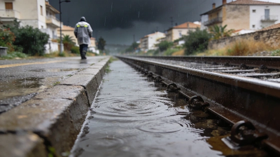
Aemet has issued red alerts for Tarragona, Castellón and Valencia. Rainfall may reach 250mm in 12 hours, with up to 90mm possible in one hour in some areas. Renfe has already suspended several services.
Renfe has suspended several long-distance services and stopped Cercanías trains in Valencia. The move came as heavy rain spread across Spain's eastern coast.
Aemet expects the worst rain later tonight and during the early hours of tomorrow. In Tarragona and northern Castellón, totals could reach 250mm in 12 hours. Some forecasts put rainfall on Valencia's northern coast at 180mm over the same period.
The agency's special notice calls the episode potentially exceptional because water levels could rise quickly in streams and other waterways. Sudden flooding is the main concern.
That risk is already affecting travel.
Authorities are telling residents to avoid unnecessary journeys and follow notices from Protección Civil. RTVE and EFE reported that the rail restrictions were tied to the red alerts and worsening conditions.
The full suspension in Valencia affected the Cercanías lines C1, C2, C3 and C6 as the weather situation worsened.
The red alert is due to remain in force from 18:00 on 1 October until 02:00 on 2 October. Other parts of the Valencian Community could receive up to 90mm in one hour.
That creates a separate flood risk. Areas with lower 12-hour totals can still see water rise quickly.
Juan Carlos Valderrama, the Generalitat Valenciana's conseller of Emergencias, said the red alert would stay in place until the next day. Officials want to avoid late-night changes to the warnings. They also want emergency services ready if rainfall shifts sharply.
Conditions are already severe in Valencia and Castellón. No serious incidents have been reported there.
Rainfall has been recorded in municipalities including Eslida and Xodar. EFE and RTVE said no major incidents had been confirmed in the affected areas at the time of their updates. The heaviest rain was still expected.
Renfe also suspended selected Euromed and Intercity services linking Catalonia with the Valencian Community, extending the disruption beyond Valencia’s commuter network. The measure reflects the wider operational impact of the red alerts on rail travel along Spain’s eastern corridor.
Renfe's decision also affected travel between Catalonia and the Valencian Community. The disruption reached beyond Valencia's commuter network.
Tarragona could face a harder morning tomorrow. The latest reports show no major complications there so far.
The danger remains.
AEMET's Aviso Especial will stay in place until Saturday for the eastern third of the peninsula. It covers heavy rain and sudden flooding across parts of the eastern Iberian Peninsula and the Balearic Islands.
Reports give different end times for Castellón. Some place the red alert's end in the morning of 2 October, while others extend it toward midday.
The focus is on rapid changes. Current conditions in one municipality do not rule out flooding later.
Rail travel is already disrupted. Long-distance services and Valencia's commuter network have both been affected, while the wider Spanish news agenda continues to show how official decisions quickly affect daily life in an earlier housing report.
Residents in the affected areas should avoid unnecessary journeys. They should monitor Aemet and Protección Civil notices and treat the red alert as an active restriction.
The forecast combines potentially extreme rainfall with a risk of sudden flooding. The most intense conditions are still expected overnight.