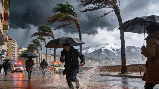
Spain faces a new wave of intense storms, with hail and strong winds hitting many regions. High temperatures and shifting pressure patterns are driving the disruption. Afternoon weather is expected to remain unpredictable.
Spain is experiencing a surge of severe storms, with hail and powerful winds disrupting afternoons in multiple regions. The combination of persistent heat and low atmospheric pressure at higher altitudes has triggered a series of intense weather events, particularly during the late hours of the day. Over the past two days, much of the country has seen heavy rainfall and sudden changes in weather, and forecasts indicate that these conditions will persist in the coming days.
According to meteorological data, the current pattern is driven by the rapid ascent of warm air, which cools as it rises and leads to the formation of cumulonimbus clouds. These clouds are responsible for the heavy downpours and localized hailstorms that have been reported. Strong gusts of wind have also accompanied the storms, adding to the disruption in affected areas.
On Tuesday, the unstable weather is expected to return, following a similar pattern to previous days. Most regions will start the day with clear skies, except for the north, where cloud cover is likely from early morning. As the day progresses, cloud formation will intensify near major mountain systems, leading to renewed storm activity in the afternoon. The most significant rainfall is forecast for areas around the Central System, with additional storms likely in the Cantabrian Mountains, the Pyrenees, the Iberian System, Sierra Morena, Montes de Toledo, the Betic System, and the interior of the Valencian Community. By late afternoon, storms are expected to spread across the northern and southern plateaus and Extremadura, with the possibility of reaching urban centers such as Madrid. In southern Badajoz, heavy rain is anticipated during the evening hours. Wind gusts will be particularly strong in parts of the Iberian and Central Systems and in some towns in Castilla-La Mancha.
From Wednesday, the distribution of storms is set to shift as high pressure returns to much of the peninsula. This change will reduce the likelihood of widespread convection, confining storm activity mainly to the western half of the country and mountainous regions. Clear skies will dominate the early hours, but by midday, storms are expected to develop in the Cantabrian Mountains, the Iberian System, the Pyrenees, the Penibetic System, and Montes de Toledo. In the afternoon, storm activity will extend to most of Castilla y León, Galicia, and Extremadura, with isolated events possible in the southern plateau. The heaviest rainfall is forecast for the northwest, particularly in the Cantabrian Mountains and León province. On Thursday, afternoon storms are likely to persist in western regions such as Extremadura and Castilla y León, as well as in various mountain systems across the peninsula.
Spain's varied geography, with its extensive mountain ranges and contrasting climate zones, often leads to rapid weather changes during the warmer months. The interaction between hot air masses and shifting pressure systems can result in sudden and intense storms, especially in inland and elevated areas. According to the Spanish State Meteorological Agency (AEMET), such patterns are typical in late spring and early summer, when temperature contrasts are most pronounced. Residents in affected regions are advised to stay informed about local forecasts and be prepared for abrupt weather shifts, particularly in the afternoons when storm activity tends to peak.