
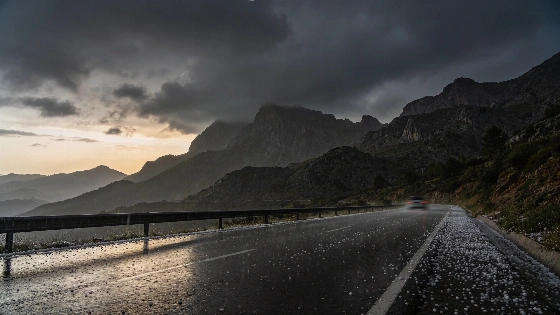
Southern Spain faces a potential weather disruption as Mario Picazo signals the risk of a DANA forming near the peninsula. The timing could coincide with the Pilar holiday, raising the prospect of intense rainfall in key regions. Uncertainty remains high as forecasts evolve.
Holiday plans in southern Spain may get upended this week. Meteorologist Mario Picazo has raised the alarm about a possible DANA—a type of isolated high-impact storm system—forming just southwest of the Iberian Peninsula as the Pilar holiday weekend begins. If it happens, the south could see heavy rain right when travel peaks.
Picazo, speaking to Eltiempo.es, pointed to a key window from Friday, October 9, through Monday, October 12. He stressed that the forecast is still changing. No one knows for sure if the DANA will form or where it might go. "Podría desplazarse por el norte de África y el sur de la Península durante buena parte del puente del Pilar," he said. These systems are unpredictable. AEMET spokesperson Rubén del Campo explained that even if a DANA appears west of the peninsula—possibly as late as Sunday, October 11—it does not mean heavy rain or damage is certain. At that point, Andalucía had no official warnings. The situation was still under review.
At the initial stage of the weather event, yellow warnings were issued for six provinces in Andalucía—Cádiz, Córdoba, Granada, Jaén, Málaga, and Seville—while Almería and Huelva were not initially included.
If the DANA develops, the far south of Andalucía, Ceuta, and Melilla could be hit hardest. These areas face the biggest risk of downpours. Still, Picazo made it clear: the final impact depends on where the storm ends up. No area is guaranteed safety. No one can be ruled out. AEMET’s territorial representative in Andalucía, Juan de Dios del Pino, said the highest risk for rain and storms was expected on Tuesday, October 6, and Friday, October 9. A second DANA could bring more instability on Friday.
The week already looks unsettled. From Monday, October 5, to Wednesday, October 7, scattered showers and storms are likely across the peninsula. The north, northeast, mountain areas, Mediterranean coast, and Balearic Islands are all on alert for strong local storms. By Thursday and Friday, some inland, western, and southern spots may see a short break in the weather. But more showers could pop up elsewhere. AEMET expected rain in all eight provinces of Andalucía. Outside the most exposed areas, rain was likely to be weak and patchy. Still, sudden heavy downpours could strike almost anywhere in the region.
Temperatures should stay close to early October averages. It will be cooler inland and milder along the Mediterranean, in the south, and on the islands. The real wild card is Monday, October 12—the Pilar holiday itself. Picazo warned that the mix of low pressure and the Atlantic anticyclone will decide if the bad weather sticks around or if things clear up. For now, the forecast is mixed. Some places will see sun, others rain or storms. AEMET expected Andalucía to cool by about 5–6 degrees, with a rebound later in the week. The region could swing from a brief warm spell to a quick drop as new fronts and storm zones move through.
The isolation of the DANA west of the peninsula could prolong unstable weather at least until Wednesday, spreading showers and storms across much of mainland Spain, with the most intense phenomena expected in the Mediterranean region.
Spain has seen sudden weather changes before. As reported earlier, late storm alerts have led to flooding and chaos in the past. That history puts extra pressure on forecasters to get it right this time.
The Pilar holiday is almost here. Travelers and locals need to stay flexible and keep an eye on updates. The forecast could shift in the final days before the break. One thing is certain: nothing is certain. That’s the reality for anyone hoping for clear skies in southern Spain this week.