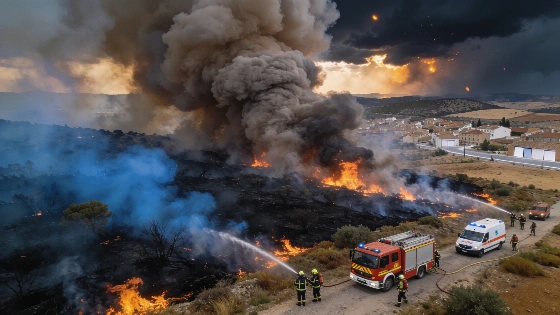
A massive wildfire between Ávila and Madrid has grown so large it now changes local weather. Firefighters face unpredictable wind and humidity. Sunday offers the best chance to contain the blaze before conditions worsen again.
The wildfire spanning Ávila and Madrid has reached a scale rarely seen in Spain, with over 77,000 hectares affected and the fire now powerful enough to alter local weather patterns. According to meteorological experts cited by EL PAÍS, the blaze has entered a phase where it generates its own microclimate, complicating efforts to predict its behavior and making firefighting operations more dangerous and uncertain.
Specialists from the Agencia Estatal de Meteorología (Aemet) observed on Saturday that the fire displayed characteristics of a so-called sixth-generation wildfire. This type of fire, due to its sheer size and intensity, can create its own convective phenomena, including sudden and violent wind gusts known as downbursts. These bursts, which can reach speeds of 80 to 100 kilometers per hour, are typically short-lived but can rapidly change temperature and humidity, making them extremely difficult to forecast and hazardous for emergency crews on the ground.
In addition to unpredictable winds, the fire is producing pyrocumulus clouds—large, cauliflower-shaped clouds formed by the intense heat and smoke. When these clouds grow large enough, they can generate dry thunderstorms, with lightning and strong local winds that risk igniting new fires and further spreading the existing blaze. The resulting smoke and ash have significantly degraded air quality, not only in Madrid but also across much of Castilla y León and even parts of Castilla-La Mancha, raising health concerns for residents in these regions.
Fire officials have been treating the separate fires in Ávila and Madrid as a single operational incident since Saturday, as the heat-driven air currents are causing the blazes to interact and potentially merge. On Saturday, embers from the Ávila fire were carried south, feeding the flames in Madrid. The complex mountain terrain further complicates predictions, as rapid shifts in wind direction are common and difficult to model with standard forecasting tools.
After several days of extreme fire risk—marked by the so-called 30-30-30 rule of temperatures above 30°C, humidity below 30%, and winds over 30 km/h—Sunday has brought a temporary improvement. Winds have eased, and humidity levels rose overnight, offering firefighters a critical window to attempt to contain the fire's perimeter. However, meteorologists warn that this respite will be brief. By Tuesday, heat alerts are expected to return, with humidity dropping and temperatures climbing back above 31°C, conditions that could again accelerate the fire's spread.
Despite the improved conditions on Sunday, the fire's ability to generate its own weather means that local phenomena—such as sudden wind shifts or dry thunderstorms—remain unpredictable. Fire commanders have prioritized direct attacks on the flames while conditions allow, but acknowledge that the fire's scale and self-sustaining dynamics make its future behavior highly uncertain.
Wildfires of this magnitude are increasingly recognized as a challenge for emergency services across southern Europe. In recent years, Spain has seen a rise in large-scale fires capable of creating their own microclimates, a phenomenon linked to prolonged heatwaves and drought conditions. These fires not only threaten lives and property but also strain public health systems due to poor air quality and complicate regional emergency planning. The current situation in Ávila and Madrid underscores the growing complexity of wildfire management in the face of changing climate patterns and extreme weather events.