
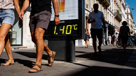
Between 21 and 27 September, France is set for a stretch of summer-like heat, with forecasts showing temperatures up to 10°C above the seasonal average. Meteorologists say this unusual warmth, driven by air masses from Morocco, could break late September records.
France is heading into an unusual late-September heatwave, with forecasts showing temperatures as much as 10°C above normal for this time of year. The European weather model points to a direct flow of hot air from Morocco, which could push afternoon highs to levels rarely seen so close to October. Earlier this month, Météo-France reported a significant heat episode, with national averages 4–5°C above normal and southern areas often topping 35°C, sometimes even reaching 40°C.
After a short cool spell midweek, the pattern is expected to flip quickly. By Sunday, heat will start moving up from the south, driven by a strong anticyclone. This high-pressure system, likely to top 1030 hPa, will settle over Brittany before shifting toward Germany, blocking Atlantic weather systems and letting warm air spread north. Météo-France forecasts that after some rain and cooler weather around 16 September, the return of the Azores anticyclone will bring back dry, sunny, and warm conditions by the end of the week.
Several independent French weather services reported as early as 14–16 September that a new heatwave could return by 20–23 September, with local highs of 30–35°C expected in the southwest and south.
By Monday 21 and Tuesday 22 September, afternoon temperatures are expected to be well above average—around 25°C in the north and 28°C in the south. These numbers are more typical of midsummer than the start of autumn. The heat is set to intensify midweek as the anticyclone moves east and winds shift to the southwest, pulling in even hotter air from Marrakech through Spain. Several French meteorological outlets back this scenario, pointing to a likely return of warmth after the brief cool period.
On Thursday 24 September, the European model predicts midday temperatures near 30°C in central France, with highs of 32°C in Pays-de-la-Loire and up to 34°C in Aquitaine. The west and southwest are expected to feel the heat first and most strongly, but the rest of the country will also be affected. If the Moroccan air mass continues north, late September could see record or near-record highs—possibly 28–33°C in the north and 30–36°C in the south during the afternoons. Still, Météo-France and other official sources note that exact figures for 21–27 September are not certain, as some models show a cooler outlook for the north and northeast.
The American model offers a different take, suggesting cooler air could reach the north of the Seine and the northeast. This disagreement means the details are still unclear, but most forecasts agree: France is in for another stretch of hot, dry weather, with drought conditions likely to worsen as rain stays scarce. Météo-France has linked the situation to ongoing dryness, noting that after the heat, "la sécheresse reste marquée," and that very dry weather is expected to continue with the anticyclone's return.
There are signs that the possible new heatwave could exacerbate water and agricultural stress, though this remains a forecasted risk rather than a confirmed consequence. Recent official materials emphasize the ongoing dry, anticyclonic weather and the return of high temperatures, but do not report any declared emergencies or new restrictions.
For now, the only certainty is that the coming week will feel more like July than late September. As the country waits to see if the Marrakech-Paris heat corridor develops fully, one thing is clear: France is seeing a run of persistent, late-season warmth that is changing expectations for autumn weather. The fact that these anomalies are happening so close to October raises questions about the stability of traditional climate patterns and the increasing unpredictability of European weather.