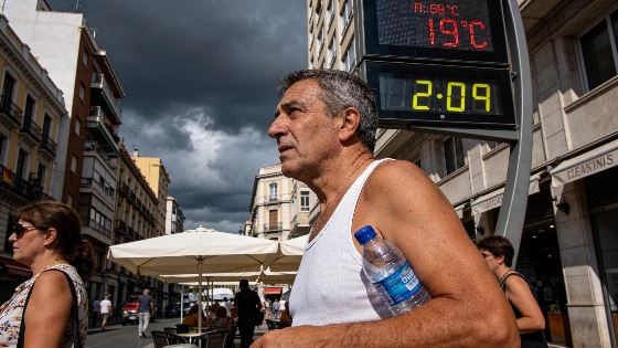
Spain sees a drop in maximum temperatures as a new front brings rain to the northwest. Despite this, heat warnings persist in the south and east. Gran Canaria remains under red alert for extreme temperatures.
Spain will see a shift in weather conditions this Monday as a new Atlantic front moves across the peninsula, bringing a noticeable drop in maximum temperatures for most regions. According to the Agencia Estatal de Meteorología (AEMET), the northwest will experience rain spreading through the afternoon, while much of the country will benefit from a brief respite from the recent heatwave.
However, the relief will not be uniform. The northeast, particularly the lower Ebro area and the province of Lleida, is expected to face intense storms with a risk of hail. These storms could also reach other parts of Catalonia and Aragón. Despite the general cooling, high temperatures will persist in the south, east, and Balearic Islands, where thermometers are forecast to exceed 35°C. As a result, heat alerts remain in effect from midday in Andalucía, Aragón, Catalonia, the Region of Murcia, and the Balearic archipelago.
Gran Canaria stands out as the most affected area, with a red alert issued due to the possibility of temperatures approaching 40°C during the day. The Canary Islands will also contend with strong trade winds and suspended dust, making conditions even more challenging. Nighttime will offer little relief in the southeast and Balearic Islands, where minimum temperatures are expected to stay above 20°C, and in some coastal and island areas, values may not drop below 25°C or even 30°C overnight.
The arrival of the front will leave heavily overcast skies in the northern half of the peninsula, while the south will see variable cloudiness that should clear as the day progresses. Calima, or Saharan dust, is forecast for the Canary Islands and the Alborán Sea area, potentially reducing air quality. Winds will be moderate from the west along southern coasts and from the south on the Galician coast, while the Canary Islands will experience very strong gusts throughout the day.
These weather changes come after a period of intense heat and instability across southern Europe. Similar patterns have been observed elsewhere, as highlighted in a recent report on record temperatures and severe storms in western Switzerland, underlining the widespread impact of this summer's extreme conditions.
Spain's weather in recent years has been marked by increasingly frequent heatwaves and abrupt shifts between hot and stormy periods. The AEMET regularly issues alerts to help residents prepare for sudden changes, especially in regions prone to temperature extremes or severe storms. The red alert for Gran Canaria is the highest warning level, indicating a significant risk to health and daily life. Residents in affected areas are advised to stay informed of updates and take precautions against both heat and sudden storms, as these conditions can disrupt transport, outdoor activities, and even power supply in some cases.