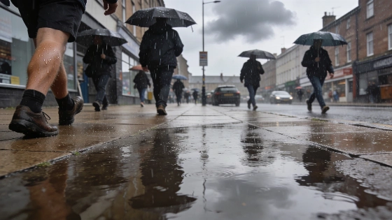
Persistent rain has returned to the North East, ending weeks of dry weather. Morning commutes face wet conditions and lower temperatures. Forecasts show a brief break before drier days return.
Unsettled weather has swept across the North East, breaking a long stretch of dry and warm days with steady rainfall and a noticeable drop in temperatures. Early Thursday brought widespread showers, particularly affecting Darlington, Bishop Auckland, and surrounding areas, as the Met Office warned of a high probability of rain through the morning hours. Residents woke to wet streets and cooler air, with umbrellas and raincoats becoming essential for the morning commute.
Gardens and parks, parched after weeks without significant precipitation, are now receiving much-needed moisture. The Met Office forecast indicates that rain chances remain elevated until midday, with temperatures struggling to rise above 16°C. By the afternoon, rainfall is expected to ease, but the day will remain cooler than recent weeks. Wind speeds are also set to increase slightly, adding to the brisk feel across the region.
Hourly forecasts for Thursday show persistent rain from 7am to 9am, with an 80% chance of precipitation and temperatures holding at 13°C. As the morning progresses, the likelihood of rain gradually decreases: 60% at 10am, 50% from 11am to 1pm, and 40% through the late afternoon and early evening. Wind speeds are forecast to peak at 10mph during the afternoon, maintaining a damp and breezy atmosphere.
Other parts of Durham, including Bishop Auckland, are experiencing similar conditions, with Thursday shaping up to be the wettest day of the week and possibly the month. However, the unsettled pattern is not expected to last. Forecasts suggest that by Friday, drier weather will return, and the weekend should bring more sunshine and a slight recovery in temperatures, reaching around 17°C.
This shift in weather comes after a period of settled summer conditions, echoing broader patterns seen elsewhere in Europe. For comparison, regions like the Canary Islands have recently faced the opposite trend, with rising temperatures and strong winds, as highlighted in a recent report on changing weather patterns in Santa Cruz de Tenerife and Las Palmas. Such contrasts underline the variability of weather across the continent this season.
For local residents, the return of rain offers temporary relief for green spaces but also brings short-term disruption to daily routines. The rapid transition from dry to wet conditions can impact travel, outdoor plans, and even local agriculture. While the current forecast points to a quick return to drier weather, the episode serves as a reminder of how swiftly conditions can change in the North East. Monitoring updates from the Met Office remains important for those planning activities in the coming days.