Spain’s Mediterranean coast is on high alert for intense storms and heavy rain. Mallorca and the Pitiusas islands face the highest risk. Weather instability will persist through the weekend, affecting travel and daily life.
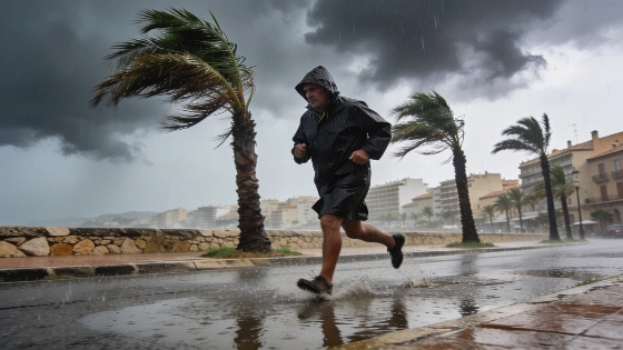
Spain’s Mediterranean coast is set for a stormy weekend, with severe weather expected to disrupt daily life and travel. The State Meteorological Agency (Aemet) has issued an orange alert for Mallorca and the Pitiusas islands, warning of heavy downpours and thunderstorms, especially during the first half of Friday. According to Europa Press and other Spanish outlets, the Pitiusas could see up to 50 liters of rain per square meter in just one hour. Mallorca is under a yellow alert, with forecasts of up to 20 l/m². Coastal Catalonia and the southeastern mountain ranges are also at risk for heavy rain and sudden weather changes. El Confidencial reports that the orange alert covers Catalonia, the Valencian Community, and Aragon, including areas like Barcelona, Tarragona, Girona, Castellón, Valencia, and Mallorca.
While the Mediterranean will see the worst of the storms, unsettled weather is expected across the country. The north will have overcast skies and light rain as a weather front moves through the Cantabrian region. Elsewhere, the forecast calls for a mix of sun and high clouds, with afternoon showers likely in the southern interior and mountain areas—some possibly strong in the eastern Béticas. The Canary Islands will have cloudy skies and light rain, mainly in the north.
"AEMET’s forecast for Friday highlighted the risk of very strong showers on the Catalan coast and especially in Mallorca and the Pitiusas, with the greatest intensity expected in the first half of the day."
— La Razón
Morning fog is expected to reduce visibility in the southeast and in some Mediterranean and northern pre-coastal areas. Temperatures will rise moderately across mainland Spain, stay steady in the Balearics, and drop in the Canaries. Nighttime lows will mostly hold steady, with slight increases in the Strait and western and northwestern mountains, and a drop in low-lying Extremadura. Weak frosts are possible on the Pyrenees peaks.
Winds will be a factor, with moderate northerlies in the archipelagos, along Galicia’s coast, and the eastern seaboard. Strong gusts are forecast for Ampurdán, the Galician coast, and especially the Canary Islands. The Strait and Alborán will have a moderate Levante, while lighter winds will prevail elsewhere—mainly from the north in the north and east in the south. The Ebro valley will see moderate Cierzo, and the northern plateau will have northeast winds. Several Spanish meteorological sources warn of gusts over 80 km/h in some coastal and Balearic areas.
On Saturday, high pressure will bring a brief break for much of Spain, but the southeast and Pitiusas will remain at risk. The area around Cabo de la Nao is expected to see the heaviest storms, with the chance of significant rainfall. Other parts of the southeastern coast and the Pitiusas could also get strong, stormy showers. Most of the country will have clear skies, with only some morning low clouds in the far north and afternoon cloud build-up in the mountains. The Canary Islands will stay cloudy in the north with light rain, and clearer elsewhere.
"Authorities in the Balearic Islands have urged maximum caution and maintained rain and thunderstorm warnings under the Meteobal plan, as the risk of local flooding is real due to the forecasted intensity of rainfall—over 50 l/m² per hour in some areas."
— Balearic Islands Government
Saturday’s temperatures will rise in most regions, with the north seeing the biggest increases—Galicia, the Cantabrian region, and the upper Ebro could reach notably high values. In the southwest, temperatures may top 35 degrees in the main valleys. Nighttime lows will drop in the Cantabrian, upper Ebro, and Pyrenees, rise in Atlantic-facing regions and the Balearics, and stay steady elsewhere. Tropical nights are likely along the southern Mediterranean and lower Guadalquivir, while weak frosts may linger in the Pyrenees.
Strong Levante winds will continue in Alborán and the Strait, with possible very strong gusts. The Cantabrian coast will have moderate easterlies, while Galicia, the southeast, Ampurdán, and both archipelagos will see moderate north or northeast winds. Elsewhere, light winds will dominate, mainly from the east.
By Sunday, high pressure will settle in, bringing clear skies to most of Spain. Only the Strait, Alborán, and southeastern coasts have a slight chance of weak, scattered showers, with low cloud cover lingering. The Canary Islands will stay mostly cloudy in the north, with a chance of isolated light rain, and clearer in the south. Morning fog is likely in the north and southeast, and Saharan dust could drift over the Canaries from the east.
Temperatures will keep rising in the north, with little change elsewhere. The southwest may again exceed 35 degrees, and the Miño valley could approach similar highs. Tropical nights are expected in the southern Mediterranean and lower Guadalquivir. Winds will stay moderate from the east on the Cantabrian and southern coasts, with strong intervals in Alborán and very strong gusts in the Strait. The southeast coast will have moderate north and northeast winds, with possible strong intervals in Galicia, and light to moderate winds in the archipelagos. Elsewhere, light easterlies will continue.
This stretch of Mediterranean storms comes as Spain faces other regional challenges, including recent border tensions in Ceuta, as reported earlier. The current weather warnings mean residents and travelers should stay alert, especially in areas under orange alert. With the risk of sudden storms, flooding, and strong winds, local authorities are urging caution and close attention to official updates. The sharp contrast between intense Mediterranean storms and soaring inland temperatures shows how varied Spain’s climate can be at this time of year. For those in affected regions, the next few days will require flexibility and attention to changing conditions.