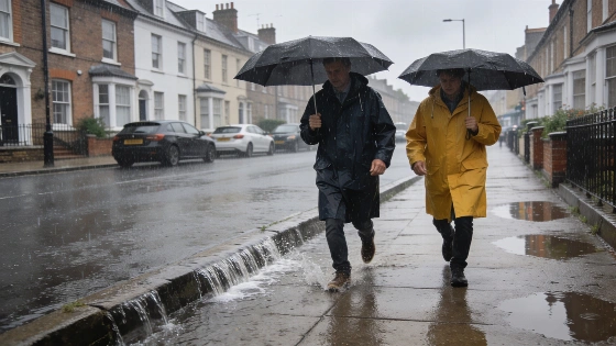
A powerful rain front will move through one hundred UK areas on Thursday, with the Met Office forecasting up to 16mm of rain in some places. This comes just days before a return to 27C temperatures.
One hundred areas across the UK are set for a sharp change in weather on Thursday, as the Met Office forecasts a fast-moving band of rain just before a predicted heatwave. Some places could see more than half an inch of rain in just a few hours.
The rain is expected to arrive early, first hitting Northern Ireland before moving east. By mid-afternoon, it will reach western parts of England, Wales, and Scotland, picking up strength as it spreads. The Lake District is likely to see the most rain, with up to 16mm expected around 5pm. According to the Met Office forecast from September 7, this Atlantic front will bring cloud, rain, and stronger winds to the west and northwest, with the heaviest rain in western Scotland by night.
Cities like Newcastle and Hull are preparing for evening downpours, while the southeast should stay dry until after dark. The Met Office says the rain will spread "erratically eastwards throughout the day," with the north seeing the worst of it. By early Friday, the rain is expected to clear, but wet ground and some disruption are likely. The Met Office has also said that while heavier rain is possible in the west and north, "widespread large rainfall totals are not expected," easing some of the earlier concerns.
The affected areas cover much of the UK. In England, this includes Bedfordshire, Berkshire, Bristol, Buckinghamshire, Cambridgeshire, Cheshire, Cornwall, County Durham, Cumbria, Derbyshire, Devon, Dorset, East Riding of Yorkshire, Gloucestershire, Greater Manchester, Hampshire, Herefordshire, Hertfordshire, Isle of Wight, Lancashire, Leicestershire, Lincolnshire, Merseyside, Norfolk, North Yorkshire, Northamptonshire, Northumberland, Nottinghamshire, Oxfordshire, Rutland, Shropshire, Somerset, South Yorkshire, Staffordshire, Tyne and Wear, Warwickshire, West Midlands, West Yorkshire, Wiltshire, and Worcestershire. Scotland's coverage runs from Aberdeen City and Aberdeenshire to the Shetland Islands and Western Isles. All counties in Wales and Northern Ireland are also included. The Met Office's morning update on September 9 notes that rain will start as scattered showers, becoming more persistent over Northern Ireland and western Scotland by midday, then intensifying over northwest England and north Wales, including the Irish Sea coast, by evening.
Despite the rain, the Met Office expects a quick turnaround, with temperatures set to reach 27C for many across the UK next week. This jump from heavy rain to summer-like warmth highlights how quickly British weather can change in early September.
Met Office
For anyone planning travel or outdoor events, the timing of the rain's arrival and departure will matter. Local authorities and transport services are preparing for possible delays and minor flooding, especially in areas with poor drainage. The full list of affected regions gives a clear guide for those who may need to change their plans.
While UK weather is always unpredictable, the scale of Thursday's rainfall—covering one hundred areas—stands out. The Met Office's early warning gives people some time to prepare, but the real impact will be seen as the rain front moves through daily routines. Even with sunshine expected soon, this forecast is a reminder that UK weather can still bring sudden, widespread disruption and requires everyone to stay alert and flexible.