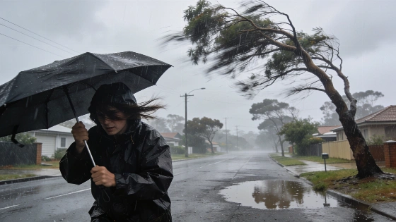
A surge of Antarctic air will hit southern Australia, bringing damaging winds, heavy rain, hail, and snow. Authorities warn of severe weather across at least four states. Flooding and power outages are possible as the system moves east.
Southern Australia is bracing for a powerful cold front set to arrive by the end of the weekend, with meteorologists warning of damaging winds, freezing temperatures, and the risk of flooding across at least four states. The system, originating from the Antarctic region, is expected to travel over 4,000 kilometres before reaching the continent’s southern coastline, according to Weatherzone.
The first impacts are forecast for Western Australia, where rain, thunderstorms, and strong winds are likely to begin as early as Friday night. In the southern parts of the state, residents have been advised to prepare for small hail and a sharp drop in temperatures. Perth is expected to see light rain on Friday, followed by more intense weather on Saturday, including gusty winds and possible thunderstorms. Although the city’s maximum temperature may reach 16 degrees, the wind chill could make it feel as cold as 10 degrees throughout the day.
South Australia is next in line, with the cold front predicted to reach the state by Saturday afternoon. Adelaide could experience the effects of the system as soon as Sunday morning, with strong winds expected to intensify the cold. The low-pressure system will continue to drag a mass of polar air across the Southern Ocean, pushing severe weather further east.
By Sunday and into Monday, the system is forecast to sweep across New South Wales, Victoria, southern Queensland, and the ACT. Heavy rain, damaging winds, hail, thunderstorms, and snow are all possible as the front moves through these regions. Forecasters have warned that the combination of strong winds and heavy rainfall could lead to destructive gusts and widespread flooding, particularly in the southeast.
Victoria, New South Wales, and the ACT are expected to see the most significant wind gusts, with the potential for the severe conditions to extend into Tasmania. While rain will be widespread, the heaviest falls are likely in the central and northeast ranges of Victoria and the southern parts of New South Wales, where some areas could receive between 50 and 100 millimetres of rain in a single day.
Such cold outbreaks are not unusual for southern Australia during the winter months, but the scale and intensity of this system stand out. The arrival of polar air masses from Antarctica can lead to rapid temperature drops, hazardous driving conditions, and disruptions to power and transport infrastructure. In recent years, similar events have caused localised flooding, property damage, and temporary school closures. Authorities typically advise residents to secure loose outdoor items, avoid unnecessary travel during peak storm periods, and monitor official weather updates for the latest warnings and safety advice.