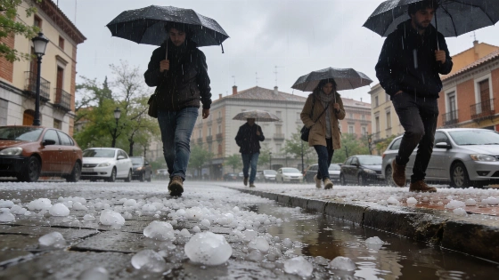
Spain faces a new wave of severe storms with hail and strong winds. Orange and yellow alerts are active in multiple regions. Authorities warn of possible flooding and dangerous conditions.
Spain begins the week under a series of severe weather alerts as storms with hail and intense rainfall threaten large parts of the country. The State Meteorological Agency has activated orange warnings for Monday in Teruel, Castellón, Valencia, Alicante, the Altiplano of Murcia, and the Hellín and Almansa areas of Albacete. These regions face the highest risk of large hail and damaging wind gusts, with rainfall potentially exceeding 30 to 40 mm in just one hour. Yellow alerts are also in place for Navarra, La Rioja, Aragón, Cataluña, Comunidad Valenciana, Albacete, Murcia, Granada, and Almería, where isolated but strong thunderstorms are expected.
While much of Spain will see stable conditions, a trough lingering from the weekend is driving the development of storm clouds, especially across the northern and eastern thirds of the peninsula. The most intense activity is forecast for the Pyrenees, Teruel, the interior of the Comunidad Valenciana and Murcia, eastern Castilla-La Mancha, and parts of Andalucía. Authorities are warning residents to prepare for sudden downpours, large hail, and strong winds, with the possibility of localized flooding in the hardest-hit areas.
According to recent coverage of weather emergencies in Valencia, similar conditions have previously led to significant disruptions, highlighting the importance of following official guidance during such alerts. Monday's storms are expected to be the most severe, but the situation will gradually improve by Tuesday and Wednesday as a ridge of high pressure moves in, bringing more stable weather to most regions.
However, some instability may persist on Tuesday afternoon, with scattered showers and storms possible in the Cantabrian mountains, southern Iberian system, interior Castellón, and the mountain ranges of Andalucía. The Pyrenees and inland Cataluña remain under yellow alert, with rainfall totals potentially surpassing 20 mm in one hour. By Wednesday, coinciding with the total solar eclipse visible in Spain, only weak and isolated storm activity is expected in the Pyrenees and eastern Andalucía. Meteorologists caution that from Thursday onwards, storm activity could intensify again and spread to wider areas as the week progresses.
Spain's weather alert system uses yellow and orange levels to indicate increasing risk, with orange signifying a significant threat to safety and property. The regions currently under alert are accustomed to rapid weather changes in spring, but the combination of hail, heavy rain, and strong winds can still cause damage to crops, infrastructure, and transport. Residents are advised to stay informed through official channels and avoid unnecessary travel during periods of active warnings. The current pattern reflects the typical volatility of Spain's spring climate, where rapid shifts between calm and severe weather are common, especially in inland and eastern regions.