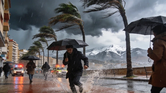
Aemet has issued orange alerts for storms and hail in parts of Valencia. Up to 40 litres of rain per square metre could fall in one hour. Authorities urge caution and warn of strong winds and flooding risks.
Valencia and Castellón face a sharp weather shift as the Agencia Estatal de Meteorología (Aemet) has activated orange alerts for severe storms and hail this afternoon. The warning covers the interior and southern coastal areas of Valencia and Castellón, where rainfall could reach 40 litres per square metre in just one hour. The alert period runs from 14:00 to 22:00, with the risk of locally torrential downpours, large hail, and very strong wind gusts.
Elsewhere in the Comunitat Valenciana, a yellow alert is in place, signalling a lower but still notable risk of heavy showers, with up to 20 litres per square metre possible in an hour. However, significant rainfall is not expected in Valencia city or the northern coast, according to current meteorological models.
Authorities are urging residents to avoid ravines, dry riverbeds, and flood-prone areas during the alert. The Generalitat Valenciana's emergency services have also advised organisers of public events to take extra precautions. With strong winds forecast, they recommend securing any objects or installations that could be affected by gusts, which may exceed 80 km/h in some coastal areas.
Alongside the storm risk, Aemet has issued coastal warnings due to the likelihood of westerly winds reaching 40–50 km/h, with occasional peaks above 80 km/h. These conditions could complicate the situation in areas already affected by wildfires. In Tírig, where a major forest fire has burned over 500 hectares, the combination of wind and possible dry storms raises concerns about new fire outbreaks or flare-ups. This echoes recent challenges faced by emergency services in the region, as seen when mass evacuations were required in Catí and other towns during previous wildfire emergencies, detailed in reports such as the recent coverage of evacuations in Segovia and Castellón.
Forecast models suggest the heaviest rainfall will begin after 14:00, with some municipalities near the Castellón-Teruel border potentially seeing up to 80 litres per square metre by evening. The southern coast and pre-coastal areas of Valencia could accumulate 60 litres, with the risk that most of this could fall in a short period. Later tonight, the storm front is expected to move north, bringing up to 60 litres per square metre to northern Castellón, and possibly 120 litres over 12 hours if predictions hold.
However, not all models agree. The European Centre for Medium-Range Weather Forecasts (CEPPM) projects much lower rainfall totals, with some areas possibly receiving less than two litres per square metre during the critical hours. This uncertainty means residents should remain alert to changing conditions.
Spain's Mediterranean regions are particularly vulnerable to sudden, intense storms, especially after prolonged dry spells. Flash flooding, wind damage, and hail can disrupt transport, damage property, and complicate firefighting efforts. Local authorities regularly update protocols and invest in early warning systems to mitigate these risks. The current alerts highlight the importance of preparedness and rapid response in the face of unpredictable weather patterns.